Translate

Monday, May 30, 2016

Arches National Park and Golden Spike National Historic Site

Arches National Park, Moab, Utah

Delicate Arch (Photo by Hunner)

I usually write histories from documents, oral history interviews, or archaeological works, you know human stuff. At Arches NP, history begins 300 million years ago. The geological history is etched in the landscape itself where 2,000 arches exist within the park boundaries. Geological time manifests itself at the Park.

Creating the Arches

Hundreds of millions years ago, this area lay under a vast sea. Along the shores and under the waves, sand dunes existed which when buried, formed sandstone, petrified sand dunes. Oceans covered the area, then evaporated, returned, evaporated, depositing thick layers of salt seventy five million years ago. A mountain range one mile thick grew over the salt deposits. The salt flowed under the earth and uplifted some of the land so that horizontal sandstone flipped ninety degrees and became vertical ranges. Around sixty million years ago, the Colorado River eroded the upper layers of that mountain range and exposed the now vertical sandstone, which when eroded further, emerged as the fins which eroded further to make the arches. Water and wind wore down the softer stone to form dramatic landscapes, not just of arches, but also balanced rocks, pinnacles, skyscrapers of red and tan structures. Water, time, and gravity made the arches.
Sandstone fins where arches come from (Photo by Hunner)
Perhaps another powerful force played a role. When salt is hydrated, it forms crystals which exert enormous pressure on anything around it. Research in New Mexico on the effect of salt on adobe buildings shows its destructive capability. The Arches Visitors’ Center exhibit notes that “both mechanical and chemical forces attack the weaker spots and begin the process which forms arches.” Perhaps salt’s expansive forces also helped carve the landscape.

This is a dynamic process. Again from the exhibit: “What you see now is the result of millions of years of gradual change. Some of the changes have been dramatic. Mountains have come and gone. Oceans gave way to deserts. The changes occurred slowly, have not stopped, and will continue as erosional forces reshape the land.” The arches we see today might collapse under its own weight, as the Wall Arch did in 2008. Like all living things, arches die. In the words of the NPS, this is a “never ending story of deposition, uplift, collapse, and erosion.”

Hiking the Arches

I spent the Thursday before Memorial Day, the busiest weekend of the year, at the Park. Almost 1.5 million people visited it in 2015. I hiked up to Delicate Arch, a three mile roundtrip that traversed the desert landscape, across the red sandstone slick rock, and around a narrow ledge hugging a cliff. The dramatic arch rose above a basin and tottered over a cliff with the snow covered La Sal Mountains as a back drop. Delicate Arch serves as the iconic image of Utah on its license plates.
Hiking over slickrock to Delicate Arch (Photo by Hunner)
I then drove to Devil’s Garden and hiked a seven mile round trip trail past several distinctive arches, including Landscape Arch and Double O Arch. I walked past collapsed arches and nascent arches, along the yard wide top of a fin with steep drops on each side, past blue varnished cliffs, and saw an arch whose span was as long as a football field and another where a small arch lay under a larger one.
The 100 yard span of the Landscape Arch (Photo by Hunner)

The over and under Double O Arch (Photo by Hunner)

Visitors from around the world converge on Arches National Park to wander in awe through this magical landscape. Although Driven by History focuses on human history, in my travels, I can’t pass up hitting some of the stunning parks of natural beauty that are jewels in the NPS crown.

Arches National Monument, designated by President Hoover in April 1929 contained about 4500 acres. President Roosevelt expanded it to 34,000 acres, and then President Johnson doubled its side in 1968. Congress voted it a National Park in 1971 with 76,000 acres.

Golden Spike National Historic Site

The replica of No. 119 making a run past the visitors' center at Golden Spike NHS. Engineer Tom Brown is waving from the cab.  (Photo by Hunner)
Next I drove to Golden Spike NHS near Corinne, Utah. In 1869, at this place, a vast continent-wide engineering and construction effort connected the Pacific and Atlantic coasts and helped unite the nation after the Civil War. Thousands of workers graded a path 1,800 miles across prairies and mountains, laying wood ties and iron rails, and completing the first transcontinental railroad line. As you enter the visitors’ center, these words greet you: “Inscribed here, amid the sagebrush and bedrock of northern Utah is a tale of grand dreams and brute work, greed and glory.” Brute force, daring engineering, and federal financing muscled the railroad across the continent.

The driving of the golden spike on May 10, 1869 culminated almost four decades of industrial progress. The earliest railroads ran in England in the first decades of the 19th century. Soon after the railroad came to the United States, people started dreaming of a “Pacific Railroad.” Embracing such public opinion, the U.S. House of Representatives in 1850 called for a Pacific Railroad that would "cement the commercial, social, and political relations of the East and the West," as well as providing a "highway over which will pass the commerce of Europe and Asia." Railroads fueled the industrial revolution in the 19th century.

While many voices advocated for a Pacific Railroad, some objected. Primarily, they did not support the federal government financing internal improvements; however for railroad companies to build a route over hundreds of miles, government support proved essential. With laissez-faire capitalism saying hands off to the government, some of the public did not want federal support of such a project. The transcontinental railroad changed this.
Transcontinental Railroad Route (www.ducksters.com)

Building the Pacific Railroad

In 1862, the U.S. Congress loaned $50 million to the Central Pacific and the Union Pacific Railroad companies to start construction. The Pacific Railway Act of 1864 loaned another $50 million to the railroad companies. These subsidies lent the railroads $16,000 for each mile constructed east of the Rockies and west of the Sierras, $32,000 for each mile between the mountain ranges, and $48,000 for each mile in the mountains.

The 1864 act also granted that for every mile laid, railroad companies received ten sections or ten square miles of land extending out from the main lines. As historian Richard White calculated, the Union Pacific received the square mileage of New Hampshire and New Jersey combined, while the Central Pacific’s take equaled the land mass of Maryland. In total, railroads around the country received 131,230,358 acres of land grants from the United States.

Railroad construction on the Pacific route went full throttle after the end of the Civil War. Often using military men as managers who had built or repaired railroads during the war, both companies raced to lay more track than the other to secure more government subsidies. The Central Pacific had the tougher route. Almost immediately after leaving Sacramento, the route climbed up the Sierra Nevada Mountains, and its progress was slowed as tunnels and steep switchbacks slowed their efforts. The Central Pacific only reached the top of the Sierras in July 1867 and a year later had descended the high mountains to link up with its Nevada construction. Much of the material for the Central Pacific had to come by sea around the tip of South America and then from San Francisco or Oakland by train to the rail head. With labor scarce, the Central Pacific hired 11,000 Chinese to grade the land, dynamite the cuts and tunnels, construct the bridges and culverts, lay the track, and hammer home the rails. Without the Chinese, the Central Pacific section of the Pacific Railroad would have taken at least twice as long as four years.

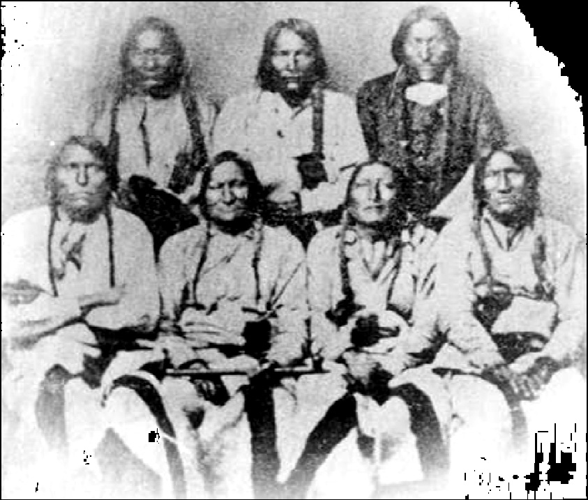
The meeting of the Central Pacific and the Union Pacific Railroads at Promontory Summit 
(Courtesy of http://up150.com/timeline/)

Here are some statistics from the visitors’ center exhibit: once the monumental feat of leveling a road bed by hand and draft animal was finished, it took 400 iron rails for a mile of track. A rail was secured to wooden ties by 24 spikes. Each spike took three blows to nail it in. Thus, each mile of track took 12,000 blows of a sledge hammer. Multiply this over 1,800 miles.

Another interesting part of the interpretation at Golden Spike NHS is the replicas of the two famous locomotives which met here in 1869. The Central Pacific’s Jupiter and the Union Pacific’s No. 119 operate in the summer and make short runs along the track outside of the center. The sounds of the whistle, the clacks of the wheels on the rails, the smell of the coal smoke, and the chuffing of the moving steam locomotive is a glorious experience.  
Golden Spike's Chief of Interpretation Justin Glasgow talking to the Mountain Valley Elementary School in front of No. 119
(Photo by Hunner)

Transforming the Nation

The transcontinentals transformed the role of the federal government in using public monies to support works for private gain. They also changed the way we experienced time and space. Prior to trains, people often measured time by how far one could travel in a day. Now distances that had taken months to traverse were covered in days.

Railroads also redefined space as they privileged what lands were important. Many established towns bypassed by the railroad withered while nearby newly created towns blessed by a station thrived. Finally, lands distant from markets now were connected to regional and even national and international businesses and customers. The railroads enabled farmers, miners, lumbermen, and other producers to send their goods across vast distances to markets.

As Justin Glasgow, Chief of Interpretation at Golden Spike mentioned, this spot transformed the U.S. from a regional economy into a world power. Justin also added that railroads ignited the protest movements at the end of the 19th century. In reaction to the monopolies and high transportation costs of the railroads, discontent farmers organized the Populist Reform movement which eventually led to Progressivism at the beginning of the 20th century. Justin concluded that railroad culture and language are still with us. For example, the national time zones we use today came about in 1883 to facilitate the railroads’ moving goods and people quickly across our vast lands.

The Golden Spike NHS preserves the monumental effort of a nation reeling from the Civil War to reinvent itself as a united country again. Tying together the Atlantic and the Pacific coasts and the lands in between, putting its industrial might to work, and building what many considered impossible, the transcontinental railroad that joined at Promontory Summit in 1869 transformed the United States perhaps as much as the Civil War. The Golden Spike NHS was created in 1965.

Visitors can auto tour and hike some of the old cuts leading up to Promontory Summit. While hiking out to the Big Fill several miles east of the headquarters, I encountered a rattlesnake near the sign below. we both quickly went our own ways.
Roadbed to UP's Big Trestle over Spring Creek Ravine. Central Pacific's Big FIll of the ravine off to the left. Sign on right is where I spooked the rattlesnake. (Photo by Hunner)
Next on the Driven by History road trip, I will visit Minidoka NHS where Japanese American citizens were imprisoned during World War II. What’s your favorite Park? Please let me know.

Monday, May 23, 2016

The Sand Creek Massacre NHS near Ead, Colorado

Sand Creek Massacre 

After I visited Bent’s Old Fort, I drove north some seventy miles to one of the most shocking events of the Indian Wars. In the words of the NPS, Sand Creek Massacre National Historic Site is “profound, symbolic, spiritual, controversial, a site unlike any other in America.” The exchanges between Europeans and Native Americans from first contact held both promise and peril. This unit of the NPS memorializes the peril, where U.S. soldiers savagely attacked a peaceful village of Cheyenne and Arapaho.

This history of the Sand Creek Massacre NHS contains graphic violence. Please don’t read on if this might upset you.  
Sand Creek Massacre (www.sandcreeksite.com)

The Massacre

In November 1864, members of the U.S. Army descended on a peaceful camp of Cheyenne and Arapahoe who displayed from their teepees the American flag and a white flag of truce. Earlier that year, a different band of Indians killed Nathan Hungate and his family. When their remains were displayed in Denver, calls for vengeance rang out. Territorial Governor John Evans issued a proclamation for “friendly Indian of the Plains” to assemble in safe havens while authorizing settlers to “kill and destroy… hostile Indians.”[1] This set the stage for the tragedy that fell on the peoples at Sand Creek who had nothing to do with the Hungate killings.

Colorado Territorial Gov. John Evans (NPS exhibit panel at Sand Creek)
Enter Col. John Chivington, hero of the 1862 Civil War battle at Glorieta near Santa Fe which stopped the Confederate invasion of the West. After the battle, Chivington kept the Glorieta veterans of the 1st Regiment together while adding volunteers into the 3rd Colorado Cavalry. These men, who missed the victory at Glorieta, had enlisted for only 100 days to fight the “Indian War of 1864.” According to Park Ranger John Laudnius, the 3rd Regiment was poorly trained, poorly equipped, and poorly disciplined.
Col. John Chivington (http://civilwardailygazette.com/wp-content/uploads/2011/11/march26chivington.jpg)
Why target this group of Cheyenne and Arapaho who had assembled in the safe haven of Fort Lyons before setting up at Sand Creek? Many of the U.S. troops, especially the 3rd Regiment had flocked to the territory of Colorado to prospect for gold and silver and wanted land occupied by Native peoples. Additionally, Gov. Evans wanted a transcontinental railroad to pass through Colorado, which meant going through the land of the Cheyenne and Arapaho.


Total War

To be blunt, European colonists and then the United States has waged total war on Native Americans for centuries. A year earlier, the army had destroyed crops of the Navajo in the Four Corners region, attacked them during a winter campaign, and forced them on the Long Walk to relocate 350 miles away. Total war targets the young, the families, the elderly to break the support and the will which Indian warriors needed for their armed resistance. Perhaps that accounts for the blood lust of the U.S. soldiers at Sand Creek.
The Encampment at Sand Creek was near the trees on the right. Soldiers came in from the right and the villagers fled to the creeks bank on the upper left (Photo by Hunner)
On Nov. 28, 1864, Chivington led 675 men with four 12-pounder howitzers into the encampment along Sand Creek. Away hunting, few adult male Indians were at the camps of Chiefs Black Kettle, White Antelope, and Left Hand. At first the women, children, and elderly thought the thundering hooves meant the return of the long lost bison. George Bent, son of Owl Woman, a Cheyenne, and William Bent of Bent’s Fort on the Santa Fe Trail (see the May 16 blog) was at the camp: “By the dim light I could see the soldiers, charging down on the camp from each side… at first the people stood huddled in the village, but as the soldiers came on they broke and fled.”[2] The U.S. troops killed indiscriminately as the Native peoples fled northwest along the creeks banks. Sometimes the soldiers fired at point blank range into the huddled families.
George Bent and his Cheyenne wife Magpie (http://www.nps.gov/sand/historyculture/images/georgemagpie)
In total, 165 to 200 Cheyenne and Arapaho died, two thirds of them women, children, and the elderly. Another 200 suffered wounds. Of the 675 soldiers, sixteen died, some from friendly fire, and seventy were wounded. Thirteen Cheyenne and one Arapaho chief were killed along with any possibility for peace. Chief Black Kettle, who survived the attack, continued his call for peace, but Cheyenne and Arapaho warriors retaliated by attacking settlers and wagon trains in the region. The NPS calls the massacre “8 hours that changed the Great Plains forever.”
Chief Black Kettle, holding a pipe in the front row, at a peace conference before Sand Creek (https://www.nps.gov/sand/learn/historyculture/images/Camp-Weld-Conference.jpg)

Those Who Refused to Fire

Some of the U.S. soldiers  disobeyed orders and did not fight. Led by Captain Silas Soule, who had attended the peace talks earlier that fall, this company of 100 soldiers refused to participate. Soule wrote an account of the slaughter: “I refused to fire.and swore that none but a coward would. For by this time, hundreds of women and children were coming towards us and getting on their knees for mercy.   Anthony shouted, ‘kill the sons of bitches’.” Soule continues with his report. “When the Indians found that they there was no hope for them they went for the Creek and buried themselves in the Sand and got under the banks…. By this time there was no organization among our troops, they were a perfect mob.” As a result, Soule recalls: “One squaw with her two children were on their knees begging for their lives of a dozen soldiers, within ten feet of them all, firing – one who succeeded in hitting the squaw in the thigh, when she took a knife and cut the throats of her children. and then killed herself.” Soule’s company did not fire a shot.[3]
Capt. Silas Soule (https://www.nps.gov/sand/learn/historyculture/images/Soule.jpg)
Some soldiers took body parts as trophies which they paraded through the streets of Denver. The Cheyenne and Arapaho did not return to the site nor did the soldiers bury those they killed. In 1868, General William Tecumseh Sherman toured Sand Creek and found human bones scattered around. He sent them back to Washington for ballistic analysis on the effectiveness of the weapons used. These human remains eventually were deposited at the Smithsonian. After the Native American Graves Protection Act (NAGPRA) passed in 1990, all federal institutions which held native human remains or sacred objects had to contact the relevant tribes to repatriate them. At the Sand Creek Massacre NHS, a Repatriation field on the bluff overlooking the creek bed now holds these remains along with those body parts chopped from the slain that have been returned by the descendants of the soldiers.

The Repatriation Field at Sand Creek (Photo by Hunner)
In the aftermath of the attack, a Congressional Joint Committee on the Conduct of the War found that Chivington had “surprised and murdered in cold blood…unsuspecting men, women, and children… who had every reason to believe that they were under [U.S.] protection.”[4] Unprovoked attacks, broken treaties, and dispossession of ancestral lands are perils of contact that our tribes and our country continue to grapple with today.

When I first arrived at the visitors’ center, a sun burned couple was asking Ranger John Laudnius questions about the place and the event. John mentioned that a rifle from that killing field came up for auction, and the NPS bought it. The park then consulted with tribal elders on what to do with it. They asked for the park to break it up into small pieces and destroy it. The woman gasped and said it was a valuable artifact. I replied that it was used to kill these tribal elders’ ancestors so destroying it made sense to me. The NPS did not destroy the rifle, but did not exhibit it either.

Native American World Views

I talked with Ranger John about this more. He explained that native peoples look at and understand the world and history differently than European Americans. When I pressed him about this, he said: Europeans think of time linearly.  All things happen on a distinct time line. Native Americans understand time cyclically and so tell their histories differently. Tribes transmit their histories orally and when a grandfather tells a story and you retell that story, you tell it as if you are your grandfather. A further complication with oral tradition emerges since tribal histories are told in their own languages. When the NPS translated those Cheyenne and Arapaho stories to English, this filter changed the narratives. From my interaction with Native Americans in New Mexico, I am continually amazed at how they perceive and understand the world.

After talking with John, I walked up the hill to the overlook of the massacre site. It is peaceful today. Crickets chirped along the trail to the overlook. Whippoorwills sang, an owl hooted from the cottonwoods that lined the dry creek bed. At the top of the hill with the encampment and massacre site spread out below, I imagined the chaos and horror as parents frantically fled or dug shallow holes in the sand to hide their children and themselves.

As I walked back to the visitors’ center, I saw a lone nighthawk swooping over the cottonwoods. I thought of Sen. Ben Nighthorse Campbell, a Cheyenne who helped create this park in 2000. For today’s Cheyenne and Arapaho, this is a place of medicine to heal wounds. The actual creek bed of the massacre site is off limits to the public. A sign hangs on the overlook barrier: “Help respect sacred ground. Please stay on this side of the fence.”
The battlefield from the Overlook with signs that say "Help Respect Sacred Ground." (Photo by Hunner)
We are no stranger to inhumane treatment of our peoples. Slavery, Indian wars, and Japanese-American internment camps are some of our biggest failures to live up to the ideals of the Declaration of Independence and our Constitution. It is a tribute to our country’s self-reflection that we have units of the NPS which preserve these tragedies. We will visit the battlefields of wars of national destiny and wars of choice, the underground railroads, the internment camps as well as the successes of our nation. They are important parts of our nation’s narrative. We will continue to celebrate our successes and our failures. In doing this, I am just following the lead of  our nation's parks.

In 2000, Congress passed, and President Clinton signed the bill creating the Sand Creek Massacre National Historic Site. It opened to the public in 2007.


[1] NPS Brochure for Sand Creek Massacre NHS.
[2] Ibid.
[4] Ibid.

Monday, May 16, 2016

Santa Fe National Historic Trail

Along the Santa Fe National Historic Trail

I became a historian because of the Santa Fe Trail. As a teenager, I hiked fifty miles of the trail with my Boy Scout troop. In the 1980s, I drove art to Denver and got grabbed by the trail again. To kick off this part of my Driven by History road trip, I will travel up the Santa Fe Trail and stop at several key places along the way.

I started my trail journey at the southern end of Interstate 25, near the border with Mexico. I traveled north along the historic El Camino Real de Tierra  Adentro (covered in the March 14th, 2016 blog). I drove north in the Beagle, through New Mexico and through my past. I punched through Albuquerque, where I grew up, and past Santa Fe where I became an adult. At Santa Fe, continuing on I-25, I left El Camino Real and followed the Santa Fe Trail.

Today, the Santa Fe Trail is a bi-national Historic Trail (created by Congress in 1987) that holds four National Park sites— Pecos National Historical Park, Fort Union National Monument, Bent’s Old Fort NHS, and Fort Larned NHS. Overall, the nineteen National Historic Trails cover over 33,000 miles that weave together the history and heritage of the United States from the early colonial periods through the Revolutionary War and nation building of the 19th century to the Civil Rights movement. The Santa Fe Trail was a main avenue of commerce and conquest in the 19th century which opened up the West as the country expanded.
The route of the Santa Fe Trail (Courtesy http://www.santafetrailresearch.com/)

The eastern terminus of the Santa Fe Trail started on the banks of the Missouri River near present day Kansas City. Six hundred of the nine hundred miles of the trail ran through Kansas, then went through Colorado on the Mountain branch or through the panhandle of Oklahoma on the Cimarron cut-off. The last 150 miles crossed northeastern New Mexico and ended at the ancient capital of Santa Fe.

The Trail freighters were hard scrabble men who muscled their loads across the prairies and over the mountains. Work started before daybreak to beat the heat of the day as these men yoked their oxen or mules. Traders made slow progress across the plains. Oxen pulled the specially made-for-the-prairies Conestoga wagons whose wheels stood as tall as a man and were loaded down with 5,000 pounds of merchandise. Wielding rawhide whips to encourage the plodding oxen, a good day’s travel on the prairies equaled fifteen miles and over Raton Pass, they often only managed to cover a half a mile. The iconic image of a Santa Fe Trail freighter includes him with his Conestoga wagon and a cigar in his mouth, given rise to the nickname of ”stogie” for the cigar. 
A Conestoga Wagon at Bent's Old Fort (Photo by Hunner)
In 1844, Josiah Gregg published The Commerce of the Prairies, which recounted his experiences as a trader on the trail. He wrote about the places and peoples he encountered, and he described the economic impact of the trade. On one of his trips, 100 Conestoga wagons carried merchandise that he estimated at $200,000. In today’s dollars, this amounted to over $4,000,000. This was a trail of commerce, not immigration like the Oregon Trail. The goods that entered Mexican New Mexico between 1821 and 1846 reoriented the people there away from Mexico and towards the United States economically, culturally, and politically. So when the Army of West lumbered down the trail, many New Mexicans were ready for a change of allegiance.

In 1846, the Santa Fe Trail changed from a road of commerce into a trail of conquest as the U.S. Army used it to invade New Mexico. With the conquering of this northern part of Mexico, thousands of New Mexicans had the border pass over them without moving a step, becoming citizens of the United States instead of Mexico. The Army of the West continued down the Chihuahua Trail to help prosecute the war, fighting in Mexico itself. We will visit the Palo Alto Battlefield where the Mexican American War started in a future blog. We will now visit the key parks along the trail from west to east.
The Army of the West entering Santa Fe 1846 (Courtesy http://www.santafetrailresearch.com/)

Pecos National Historical Park

One of the most majestic places on the Santa Fe Trail is the Pecos National Historical Park. As the gateway between the Rio Grande Valley and the prairies, the Pecos Pueblo was situated at a strategic point during both the pre-contact period as well as after Europeans entered the region. Native Americans had passed through this gap in the mountains for millennia and when the Chacoans dispersed after the 13th century, some migrated to the Pecos River Valley. Small settlements developed which eventually gave rise to a large pueblo around 1450. As a cultural broker and trade center between the pueblos along the Rio Grande and the Plains Indians, Pecos Pueblo played a prominent role for centuries. The Spanish explorer Coronado launched his exploration of the prairies in search of the fabled city of Quivira from the Pecos Pueblo in 1541, and a Franciscan priest built the first church there around 1620. The fortunes of the people of Pecos declined after that from diseases brought by the Spanish, from the turmoil of the Pueblo revolt, and from raiding by the Comanche.  By the time the Santa Fe Trail passed under the shadow of its massive adobe church and pueblo walls, the Native Americans had abandoned the community.

Fort Union National Monument

Another fort along the Santa Fe Trail lays in east central New Mexico. Just south of the junction of the Mountain and Cimarron branches near Watrous, Built in 1851, Fort Union housed soldiers who protected the trade along the trail, offered a quick respite to the Colorado volunteers during the Civil War who rushed to defend New Mexico from the Confederate invasion, and mounted expeditions to subdue the Plains Indians during the Indian wars after the Civil War. In 1862, the fort became the primary quartermaster depot in the Southwest, and many traders on the trail made handsome profits supplying the fort and its far flung military actions. Fort Union collected and then distributed materiel and goods to the other forts in the region.
Commanding Officers Quarters at Ft. Union NM (Courtesy NPS)

Bent's Old Fort National Historic Site

In southeast Colorado, in 1833, the brothers William and Charles Bent along with Ceran St. Vrain built a massive adobe fort. Bent’s Fort quickly attracted Plains Indians, traders, buffalo hunters, and Hispanics travelers who shared the comforts of one of the few places on the trail that offered some amenities. They also restocked their provisions for their journey to or from Santa Fe and Kansas City. Eighteen year old Susan Shelby Maggofin, a newlywed accompanying her trader husband, Samuel, arrived at Bent’s Fort in July 1846, following the Army of the West. Her journal of the trip, Down the Santa Fe Trail and into Mexico, offers a fascinating account of her journey. Out on the prairies during the first leg of the trip, she wrote: “There is such independence, so much free uncontaminated air, which impregnates the mind, the feelings, any every thought, with purity. I breathe free without that oppression and uneasiness felt in the gossiping groups of a settled home.” At Bent’s Fort, she suffered a miscarriage. She wrote:  “In a few short months I should have been a happy mother and made the heart of a father glad.” She recovered at the fort before she and Samuel rejoined the caravan on their march of conquest.
The entrance to the fort and the interior courtyard below (Photos by Hunner)
At first, the fort prospered through trading for beaver pelts with the region’s tribes. After the beaver played out, buffalo robes caught on as an economic resource. A costumed interpreter I met at the fort, Celia Dubin, said that the decline of the American bison started even before the massive kill-off perpetrated by European hunters. As an environmental biologist, a natural resource manager, and a science educator, Celia talked about how the demise of the bison began when the Indians targeted the females because they had shorter hair and so were easier to tan, but with robes still just as warm.


At Bent's Old Fort, I talked with John Carson, a living historian at the site. We sat on a rough-hewn bench under the south portal, out of the sun. He said he played two types of characters at the Fort-- a generic trapper, and Kit Carson, his great grandfather. He has worked there for ten years, coming from a nearby college where he taught college. John is a bit grizzled, with his greasy fringed and patched leather pants and his chewing tobacco. He filled me on the history of the fort which last from 1833 to 1849. As a respite for trail travelers, as a fur trading post, and as a way station for the U.S. Army of the West's conquest of the Southwest, Bent's Fort served many people. John invited visitors to experience how people lived 170 years ago at this unique unit of the NPS. 

John Carson above talking to a school group and Celia Dubin at her fire. (Photos by Hunner)
In 1954, the state of Colorado purchased the land and the ruins of Bent’s Fort. President Eisenhower authorized the creation of it as a NHS in 1960. After extensive archeological excavations in 1954 and 1963, the NPS rebuilt the fort on the foundations of the original one in 1976. They made and used over 160,000 adobe bricks for the reconstruction.

Fort Larned

The Santa Fe Trail had been a route of commerce and conquest for almost forty years before Ft. Larned was built. By then, according to Fort Larned’s Chief Interpreter George Elmore, about half of the freighting done over the trail was conducted by Hispanics. They now have an exhibit panel and mannequin about José Librado Gurulé who as a teenager traveled the trail in 1867 and passed through Ft. Larned. His story was recorded as part of the Federal Works Progress interviews in 1940 when he was 88.
Ft. Larned (Photo by Hunner)
Many people passed through the fort. George Custer, Kit Carson, Buffalo soldiers after the Civil War, and Col. Rockwell. Rockwell built the fort and had the unique distinction of witnessing two presidential assassinations. He helped carry Lincoln’s barely alive body from Ford’s Theater, and he also attended Garfield when he was shot and died.


George concluded that phenomenal stories come from the people who were at Ft. Larned, that each room tells a story. Indeed from the barracks recreation with bunks that slept two to a level and uniforms and rifles hugging the walls to warehouses and officers’ quarters, the tales of the people stationed here and the travelers passing through recount the drive and might that inserted Europeans into the Great Plains and the Southwest, into places previously the abode of Native Americans and the Spanish.
Barrack room for enlisted men at Ft. Larned (Photo by Hunner)

The Importance of the Santa Fe Trail

The Santa Fe Trail opened up the southwest to commerce and then conquest, resulting in the annexation of half of Mexico to the United States in 1846. The trail also helped with the expansion of the United States into the Pacific Northwest. The thousands of Santa Fe Trail wagons that transported thousands of tons of goods across difficult terrain perfected the technique of this form of conveyance. The Conestoga wagons, the organization of the train, the trail blazing, and the way that people traversed unknown territory were first tried and improved along the Santa Fe Trail. This technique of overland traveling then was used on the Oregon and California Trails. Without the trial and error along the way to Santa Fe, thousands of immigrants who went to Oregon and California beginning in the 1840s might have perished on the way. The tens of thousands of people who immigrated to the Willamette Valley in Oregon and other points in the northwest in the 1830s and 1840s and who rushed to the gold fields of California and Nevada after 1849 used the tried and true methods of trail travel first perfected on the way to Santa Fe.

At the end of the Santa Fe Trail, I say good bye to the Beagle. It has been a great way to see the trail and its historic sites and many thanks go to Nancy and Peter for lending it to me.

The HMS Beagle at Bent's Old Fort

Monday, May 9, 2016

Trails West Road Trip

Start the Beagle

This week, I start my road trip. From now to the end of June, I am driving to history at those places where historic events actually happened. I will visit places of both cultural significance and natural beauty and continue to write about the parks and my travels. The people and places I encounter along the way will drive the stories that will fill this blog.
Map of NPS Historic Trails in the United States

Here is a revised itinerary of the west coast trip with the reasons that these parks are chosen:
5/11                Leave Las Cruces on el Camino Real de Tierra Adentro and Santa Fe Trail NHT.    
                      Trails of commerce and conquest during Spanish colonial and U.S. territorial times.
5/12                Bent's Old Fort NHS and Sand Creek Massacre NHS, Colorado. A Santa Fe Trail    
                      trading post and the site of a massacre of Cheyenne and Arapaho by U.S. soldiers.
5/13                Ft. Larned NHS, Kansas. Another U.S. Army post along the Santa Fe Trail.
5/14                Driving to history along the Cimarron Cut-off of the Santa Fe Trail
5/15                Return to Las Cruces

5/26                Leave Las Cruces
5/27                Moab, Utah and Arches NP
5/28                Golden Spike NHS, Utah. The Union Pacific and Central Pacific railroads united the
                        nation here in 1869.
5/29                Gray's Lake National Wildlife Reserve, Idaho. The summer nesting place for the      
                        sandhill cranes who winter near Las Cruces at the Bosque de Apache NWR.
5/30                 Minidoka NHS, Idaho. A World War II Japanese American internment camp.
5/31                 Driving to history   
6/1                   Nez Perce NHP, Idaho. The Nez Perce tried to escape a forced relocation to a
                        reservation on a heroic 1,200 mile march.
6/2                   Hanford (of the Manhattan Project NHP), Washington. Plutonium for the atomic
                        bomb was made here.
6/3                   Driving to history
6/4-7               Klondike Gold Rush NHP, and Mt. Rainier NP, Washington.
6/8                  Lewis and Clark State Park, Washington and Ft. Clatsop NM, Oregon. Lewis and
                        Clark’s Corps of Discovery wintered here in 1805-06.
6/9                   Driving to history
6/10                 Redwoods NP, California. Stands of majestic trees are preserved along the Pacific
                        coast.
6/11                 Driving to history.
6/12-16           Golden Gate National Recreation Area (NRA), Rosie the Riveter/World
                        War II Home Front NHP, Muir Woods, California. The Golden Gate NRA combines
the natural beauty of the Bay Area with the strategic port defended by forts and
armaments. Rosie the Riveter celebrates the women on the Home Front that helped win World War II. Muir Woods is named after the Sage of wilderness.
6/17                Sutter’s Mill, California. Gold, I tell ya, Gold!
6/18-20          Yosemite NP, California. Hello—It’s Yosemite!
6/21-22          Sequoia NP, California. Some of the tallest trees in the country.
6/23                Manzanar NHS, California. Another Japanese American internment camp during
                       World War II
6/24               Driving to History
6/25-26         Grand Canyon NP, Arizona. It’s deep.
6/27               Driving to History
6/28               Casa Grande NM, Arizona. One of the first NM units to protect a pre-contact
                      Native American ruin. Return to Las Cruces, New Mexico.

The Creation of National Parks, National Monuments, and the NPS

To explain the different units in the NPS will take some time, so get comfy. In 1872, Congress created a federal, a National Park at Yellowstone out of the Territories of Montana and Wyoming. Yellowstone set the stage for the today’s Parks that awe us, nurture us, revive us, inspire us, and instruct us about our country. In the twenty years after 1872, Congress approved five more National Parks (NP). These are jewels of the natural world with jagged mountains, majestic trees, and towering granite domes.

In 1906, Congress passed the Antiquities Act which gave the president the power to administratively designate and protect public lands as a National Monument (NM). It allowed presidents “to proclaim and reserve historic landmarks, historic and prehistoric structures, and other objects of historic or scientific interest.”[1] Originally, NMs focused on pre-contact Native American sites.
Map of National Monuments in the U.S. and who manages them


In August 1916, Congress passed and President Wilson signed the National Park Service Act which we celebrate this centenary year. The NPS has dramatically changed over the years. What do those acronyms like NHS, NHP, NB, NBP, NST, and PWKY mean? There is little difference between National Historic Sites (NHS) and National Historical Places (NHP). NHS are often smaller than NHP, but not always. National Battlefields (NB), National Battlefield Parks (NBP), and National Military Parks (NMP) honor the sites of combat within our country’s boundaries and on some of the U.S. overseas protectorates. Parkways (PWKY) and National Historic Trails (NHT) mark the historic as well as the scenic transportation networks that spread colonization, conquest, and commerce across the continent. When some people say National Parks, they mean all 410 units of the NPS. Others mean just the special fifty-nine NPs so designated.To find your park, visit:  https://www.nps.gov/findapark/index.htm.

To confuse matters even more, in 1933 a massive consolidation and reorganization occurred under President Franklin Roosevelt. The parks, memorials, battlefields, and monuments previously owned and operated by the War Department, the National Memorials, the National Capital Parks, and the Agriculture Department’s National Monuments joined the NPS system. For more information about the various designations for NPS units, go to:  https://www.nps.gov/goga/planyourvisit/designations.htm

Basically, the NPS has two general types of parks—those that are natural beauties and wonders and those that are culturally or historically significant to our past. National Parks, National Seashores, Scenic Rivers, Wild Rivers, and others preserve nature. National Monuments, National Historical Parks, National Historic Sites, and such units oversee our heritage. For a historian who loves nature, driving to the parks this centenary year brings joy to my heart.

Creating parks, funding parks, presenting parks to the public has often been embroiled in politics and profit. Those who want to utilize the resources of the parks, the lumber, the oil, the grazing rights, and the minerals don’t want anything to obstruct their access. Those who want to preserve the natural and cultural resources for future generations have to fight to create these special units and continue to fight for protection even after they are made.
The Regions of the NPS

On the Road Again

The future Driven by History posts will change. Up to now, the park histories came from research and writing that sometimes took several months. Now I will research and write on the fly and on the drive. Granted, I will be freshly immersed in the places, but still, the blogs will be different. They will be more placed based, and posts will come as I visit them, not in a chronological narrative. In truth, I have no idea what the road writings will turn into. Like life, it’s a work in progress with everyday routines sparked by surprises.

After the west coast trip, I will embark on a longer eastern and southern trip over the fall, visiting more parks, meeting more Americans, and writing. The NPS motto this year is Find Your Park. For me, it is Show Me Your Park. Let me know what your favorite park is. You can reach me at jon.hunner6@gmail.com.
Me and the Beagle at a rest stop above Las Cruces with the Roadrunner Sculpture by Olin Caulk

This is trip is made possible by another great American idea (besides the Declaration of Independence and the National Parks)—public education. Thanks to the History Department at New Mexico State University, especially Dwight, Peter, Mark, Bill, and our chair William Storm. Dwight Pitcaithley as a past chief historian of the NPS has guided my trip in many ways. Thanks to the history students who have helped in this, especially my research assistant Brianna Barcena. Many thanks go to Nancy and Peter, owners of the HMS Beagle, for its use over the Santa Fe Trail. Thanks to Kim, Jim, Beth, John, Cécile, Douglas, Peter W., Stuart, Sabette, and many others who have listened patiently to my zany ideas and helped with this project. Finally, thanks to the people of New Mexico who employ me and who enable me to be driven by history.


[1] Barry Mackintosh, The National Parks: Shaping the System (Harpers Ferry: Harpers Ferry Center, 1991), 15.

Monday, May 2, 2016

Independence Historical Park at Philadelphia, Pennsylvania

Creating the Constitution

Between the Declaration of Independence and the U.S. Constitution, the American Revolution swept through the colonies pitting friends and families against each other. In truth, it was a civil war. We will explore the battles of the War for Independence in future postings, while today we will stay with the Independence Hall and explore the creation of our democracy.

As the war progressed, most people realized that the Articles of Confederation did not work. No state honored all of their federal taxes since there were no penalties. At times, Georgia and New Jersey refused to pay anything. Consequently, the Confederation government lacked the money to pay even the interest on its foreign debt. By 1786, the United States defaulted on its debts from the war as they came due. Changes had to happen.


Constitutional Convention

The Constitutional Convention convened on May 14, 1787 when delegates returned to Independence Hall in Philadelphia to correct the Articles. By mid-June, the delegates switched from revising the existing Articles to creating a totally new type of government. Many issues might have derailed an agreement among the diverse and divisive states:  how much power to give the federal government; how to elect representatives to Congress and how many should come from each state; who could vote; when to hold elections; and how to change the constitution and thus the government? Delegates debated all of these issues and more through the summer of 1787 in the State House.

In seeking a better government, Americans turned again to the Enlightenment philosophies of the Englishman John Locke, the Frenchman Montesquieu, and other Europeans. Conceding that humans were corruptible and lusted after power, these philosophers did not count on the goodwill of humans to temper our excesses. As Virginian James Madison observed: “if humans were angels, no government would be necessary.”  Despite creating a democracy to give the public power over government, our country’s founders did not truly trust people.
James Madison, delegate from Virginia (Courtesy http://www.biography.com/)
To counter human nature, the delegates turned to Montesquieu who championed the separation of power between the executive, legislative, and judicial branches to protect individual freedoms. Only power checking power could preserve the hard won liberty. Such borrowings from enlightenment thought found fertile ground in the deliberations to revise the Articles of Confederation.


Virginia versus New Jersey

The convention debated two models of democracy —the Virginia Plan and the New Jersey Plan. The Virginia Plan, written mainly by James Madison, favored empowering the states with the larger populations. It proposed a federal government with three branches to insure checks and balances to prevent abuses of power. The legislative branch had two houses—one elected by popular vote for three year terms and the other selected by state legislatures for seven year terms. Representation was based on population – larger states had more elected officials in both chambers.     

The New Jersey Plan, also known as the Small State Plan, challenged the Virginia Plan when William Paterson presented it to the Constitutional Convention on June 15, 1787.  To counter the disproportionate power that the more populated states would garner under the Virginia Plan, this alternative called for a unicameral body with one vote for each state like under the Articles of Confederation. In a compromise cobbled together by the Connecticut contingent, aspects of the New Jersey Plan were incorporated into the final draft. This created a bicameral legislature with a House of Representatives apportioned by population and a Senate which granted equal votes to each state, big or small.

After debate and compromise carried out over the summer, the Constitutional Convention adopted the new Constitution on September 17, 1787 and sent it out from Independence Hall to the states for approval. Ratified by conventions in eleven States, the Constitution went into effect on March 4, 1789. As the supreme law of the land, the Constitution formed a model for representative government that launched a democratic revolution around the world over the next two centuries.
The Preamble of the U.S. Constitution
The Constitution created three units of the federal government—an elected bicameral legislature, an elected president in charge of the executive branch, and an appointed judicial system. All three have duties to ensure a separation of powers to safeguard against abuses. For sharing power between the federal government and the states, national laws take precedence, but funding flows to the states. Finally, the Constitution describes how to ratify it and how to amend it.

The Constitution paradoxically empowers and protects citizens from the entrenched interests of the economically and politically powerful while at the same shielding those elite interests from power of the people. Checks and balances do minimize the abuse of power by our leaders as well as the same by the many. Our founding fathers did not fully trust the American people, both the wealthy as well as the rest of us to do the right thing.
"Scene at the Signing of the Constitution of the United  States" by Howard Chander Christy

Democracy as a blood sport

From the beginning, political combat between opposing forces has shaped our society. That is the history that drives us and our culture. Some of our citizens embrace  personal liberties so much that they want little or no regulation on individual and corporate activities. This group feels threatened by government. Others support government in regulating the excesses of the powerful. Who does the most to protect our freedoms—people in business or people in government? As part of the government that regulates and protects, the NPS serves on the front lines of this basic battle of what to save and what to use in our land.

This plays out in interesting ways. Story of AZ who thought he owned the Grand Canyon.
The Constitution provided the framework for the success of our republic. It held many firsts as historian Joseph Ellis states:  it established the first modern nation sized republic; it created the first wholly secular nation; and it created a government with overlapping agencies where multiple states and their divergent interests worked together. Despite the strengths of the Constitution, the Founding Fathers avoided several areas which belied the phrase that all men are created equal. For a nation created on equality, slavery existed and in the coming century, grew in some states and territories. Native Americans did not receive equal protection and in fact, lost land and rights. Women did not win the right to vote until the 20th century. While the Constitution serves as a model for democratic governance around the world, it also held some almost fatal flaws as well. 


Sacred Space at Independence Hall.

The colonial men and women had fought a long and difficult war to free themselves from King George and the Parliament. Some of the plans and justifying documents came from Independence Hall in Philadelphia. As the war ended and the new country struggled to create a government acceptable to the all of the states, the hall once again hosted the intense debates and the drafting of the new republic. The resultant Constitution of the United States has for more than two centuries served as a model for democratic governments around the world.

From May 1775 to 1783, Independence Hall served as the principal meeting place for the Second Continental Congress and from 1790 to 1800 was the temporary capital of the new country. The newly formed Congress and recently elected President Washington conducted their business next door in the Congress Hall as the nation’s permanent capital was built south of Philadelphia on the Potomac River.

At first, Independence Hall and the surrounding buildings that had played such a vital role in the Revolution and forming of the Republic did not attract much public attention. In the 1820s, one room in the State House was designated as Independence Hall and the surrounding block as Independence Square. A first floor museum opened in 1876, and the second floor restored in 1897. On June 28, 1948, the U.S. Congress authorized the Independence National Historical Park which was then formally established on July 4, 1956. Independence Hall became a UNESCO World Heritage Site on October 23, 1979. The area around Independence Hall is sacred ground for democracy.

Millions of people from around the world have converged on Philadelphia, have tramped over the grassy mall, lined up to view the Liberty Bell, toured Independence Hall and the Portrait Gallery, and visited the other sites of this National Historical Park. They all come to look for America.
People lined up to view the Liberty Bell (Photo by Hunner)

Independence National Historical Park
143 South Third Street
Philadelphia, PA 19106
(215) 965-2305

http://www.nps.gov/inde/index.htm

Monday, April 25, 2016

Independence National Historical Park at Philadelphia, Pennsylvania

Philadelphia at the Center of Revolution

We trick ourselves by thinking that the past had to happen the way it did, into thinking that the American Revolution was inevitable. Totally different results and consequences could have spun out of it. Indeed, the colonials argued among themselves about rebellion. About 1/3rd of them, the colonial Tories, stood by Britain. Another 1/3rd, the Patriots, sought independence, and a rest of them remained neutral. Like today, disagreements about politics and change tore apart families and communities up and down the Atlantic seaboard. Much of the intellectual fervor centered in Philadelphia.

Philadelphia nurtured a yeasty think tank for rebellion and democracy as debates rang through the streets, meeting rooms, and taverns. From the beginning, Philadelphia attracted political thinkers and then hosted the delegates who invented a revolutionary government. Ancient Greek and Enlightenment philosophers inspired the colonials to revolt and to create a new form of government. At Philadelphia, the intellectual reasons and emotional appeals for the rebellion and establishment of a democracy flourished.

A unique colony, Philadelphia was founded for religious freedom and tolerance. Given by King Charles II in 1682 to Quaker William Penn and his Friends, Philadelphia quickly thrived as a business and intellectual center for the colonies. Its lively port, its central location between the north and south colonies, its gateway to the productive western lands, and its embrace of the many peoples who flocked there created a vibrancy that anchored the tumult of the second half of the 18th century.

It was one thing for rebels in Massachusetts to start shooting at the Redcoats. It was another thing altogether for a new Congress to fund and prosecute a revolution while governing on the fly. Much of the debate and planning happened in Philadelphia’s Pennsylvania State House, now known as Independence Hall. Some of the most important moments in the founding of our republic occurred at this State House. The drafting of the Declaration of Independence in 1775, organizing the army, and then the creation of the Constitution in 1787-1788 all took place here. Philadelphia held a unique position for the rebellion and the nascent republic. Actions taken there drive us to ourselves today.
Independence Hall in Philadelphia (Photo by Hunner)

The Continental Congresses

Responding to the Intolerable Acts which punished Boston for its Tea Party, Benjamin Franklin called for the First Continental Congress to meet at the Carpenters’ Hall in Philadelphia beginning September 5, 1774. This Congress issued a “Declaration and Resolves of the First Congress” which declared “That the foundation of English liberty, and of all free government, is a right in the people to participate in their legislative council.”[1] Although a birthright for Englishmen, political representation remained elusive for the colonials. To force the issue with Parliament, the First Continental Congress called for the boycott of British goods and for communities to form committees to monitor compliance. These grass roots units served as the organizational and communication network that bound the disparate colonies together. With these and other actions, the First Continental Congress disbanded in October 1774. Several months later, the American Revolutionary War erupted around Boston (as described in the previous posting on the Minute Man National Historical Park). War dramatically altered the next congress.
Benjamin Franklin as shown at the Portrait Gallery in Independence
National Historical Park (Photo by Hunner)

The Second Continental Congress convened on May 19, 1775 at the Pennsylvania State House. The State House, built in the 1730s, served as a seat of government first for the colony and then for the Revolution. This Congress sent the Olive Branch Petition to King George III proclaiming American loyalty to Britain, which the king rejected. Instead, the King declared that the colonies were in revolt and ordered his army in Boston to treat the colonials as “open and avowed enemies.” Not surprisingly, this poured fuel on the revolutionary fire.

In anticipation of a growing conflict, the Second Congress created the Continental Army on June 14 with Virginia delegate George Washington its commander-in-chief. Congress chose Washington because he had distinguished himself as a military leader in the French and Indian War and because Virginia played a leadership role in the revolt. From Philadelphia, Washington wrote to his wife Martha: “It has been determined in Congress that the whole army raised for the defense of the American cause shall be put under my Care, and that it is necessary for me to proceed immediately to Boston to take upon me the command of it.”[2] He rushed north to Boston.
George Washington at Portrait Gallery (Photo
by Hunner)
Martha Washington at Portrait Gallery (Photo
by Hunner)


Congress in the spring of 1776 defiantly moved to declare independence, to seek foreign allies, and to unite the colonies in North America. A “Committee of Five” led by Thomas Jefferson drafted a resolution which the Congress debated in a stifling June heat wave.

The Declaration of Independence

In contrast to European governments, the Declaration proclaimed that “all people are created equal,” that governments derived their “just Powers from the consent of the people,” and that people needed to “alter or abolish” a government which curtailed their rights. After establishing the natural and legal rights of people to seek freedom from an unjust government, the rest of the Declaration listed twenty-seven specific abuses perpetrated by the King and Parliament against the colonies.

Fifty-seven representatives from all thirteen colonies signed the Declaration of Independence in the Assembly Room of the Pennsylvania State House on July 4, 1776. The declaration launched our democracy and has inspired people from around the world with its call for equality and freedom; however written by slave owners and devoid of a woman author or signer, this call for liberty and freedom is still a work in progress.
Declaration of Independence fro the British colonies (http://www.founding.com/repository/imgLib/20071018_declaration.jpg)
Over the years, people from Wallace Stegner to Ken Burns have called the National Park Service “American’s Best Idea.” Former NPS chief historian Dwight Pitcaithley disagrees: “Is it really the best idea we ever had of all the ideas in this democracy? It seems to me that Thomas Jefferson’s 2nd paragraph in the Declaration of Independence: ‘We hold these truths to be self-evident, that all men are created equal and are endowed by their creator with certain unalienable rights, such as life, liberty, and the pursuit of happiness’ is really the best idea we ever had.”[3] As good as our Parks are, this best idea took shape at Independence Hall in 1776.

Visitors to Independence National Historical Park today wait in long lines to view the Liberty Bell. This cherished symbol of American Independence was cast in 1752 in England with the legend “Proclaim LIBERTY throughout all the land unto all the inhabitants thereof.” The bell often summoned lawmakers to legislative sessions. To mark the reading of the Declaration of Independence on July 8th, the Liberty Bell rang in the State House tower.

Although the delegates from the colonies agreed on the Declaration, it needed public support as well. To help rally Virginians to the cause of independence, Patrick Henry gave a rousing speech to the House of Burgess in Richmond. Complaining about British soldiers on American soil, Henry posed: “They are sent over to bind and rivet upon us those chains which the British ministry have been so long forging…. We have done everything that could be done to avert the storm which is now coming on…. Three million of people, armed in the holy cause of liberty, and in such a country as that which we possess, are invincible by any force which our enemy can send against us.” Henry concluded: “I know not what course others may take, but as for me, give me liberty, or give me death.”[4] With such rousing orations, public support for the rebellion rose. 
Patrick Henry calling for revolution
(http://dailysignal.com/wp-content/uploads/150323_HenrySpeech.jpg)
In the winter of 1776 and again in the fall of 1777, Congress retreated from advancing Redcoats and abandoned Philadelphia for Baltimore. Threatened by hostile forces, Congress continued to draft the “Articles of Confederation and Perpetual Union” amid the chaos of war.

The Articles of Confederation

The debate on what type of national government to create pitted populous states against smaller ones, northern against southern states, and those who favored a strong national government versus those who wanted a weak one. The smaller states prevailed on representation as each state got one vote in the Confederation. When Congress forwarded the Articles to the colonies, Virginia ratified it first on December 16, 1777 while Maryland approved it last on February 2, 1781. As the Revolutionary War waged across the colonies, Congress struggled to finance the war with borrowed money.
Front page of the Articles of Confederation (Courtesy Library of Congress)
The Articles established the rules and duties for the national government which included prosecuting war and seeking peace, negotiating diplomatic and trade agreements, and settling disputes between states. However, it was obvious that the Articles did not work. They did not give the national government the power to raise money through taxes. No state honored all of their financial obligations, and at times, Georgia and New Jersey refused to pay anything. Consequently, the Confederation government had little money to pay even the interest on its foreign debt. By 1786, the United States was defaulting on its debts as they came due. Changes had to happen. The resultant creation of the Constitution of the United States at Independence Hall in 1787 is next week’s posting.

Congress designated Independence Hall a National Historic Site in 1943 followed by National Historical Park status in 1948. The following sites are some, but not all, of the buildings that comprise the Independence National Historical Park:
Independence Visitor Center - 525 Market Street
Independence Hall - 520 Chestnut Street
Liberty Bell Center - 526 Market Street
Portrait Gallery- 420 Chestnut Street
City Tavern - 138 S. 2nd Street
Park Headquarters - 143 S. 3rd Street

Millions of people from around the world have driven through Philadelphia, stood in line to view the Liberty Bell, toured Independence Hall and the Portrait Gallery, and visited the other sites of this National Historical Park.

Its history drives us.

Driving by Independence Hall (Photo by Hunner)
Independence National Historical Park
143 South Third Street
Philadelphia, PA 19106
(215) 965-2305
http://www.nps.gov/inde/index.htm


[1] Bruun and Crosby, Our Nation’s Archive, 116.
[2] Kelly, Best Stories of American Revolution, 85.
[3] Interview of Dwight Pitcaithley by Jon Hunner for Storycorps, Jan. 6, 2016 in Las Cruces, NM.
[4] Bruun and Crosby, Our Nation’s Archive, 118-19.