Translate

Monday, May 9, 2016

Trails West Road Trip

Start the Beagle

This week, I start my road trip. From now to the end of June, I am driving to history at those places where historic events actually happened. I will visit places of both cultural significance and natural beauty and continue to write about the parks and my travels. The people and places I encounter along the way will drive the stories that will fill this blog.
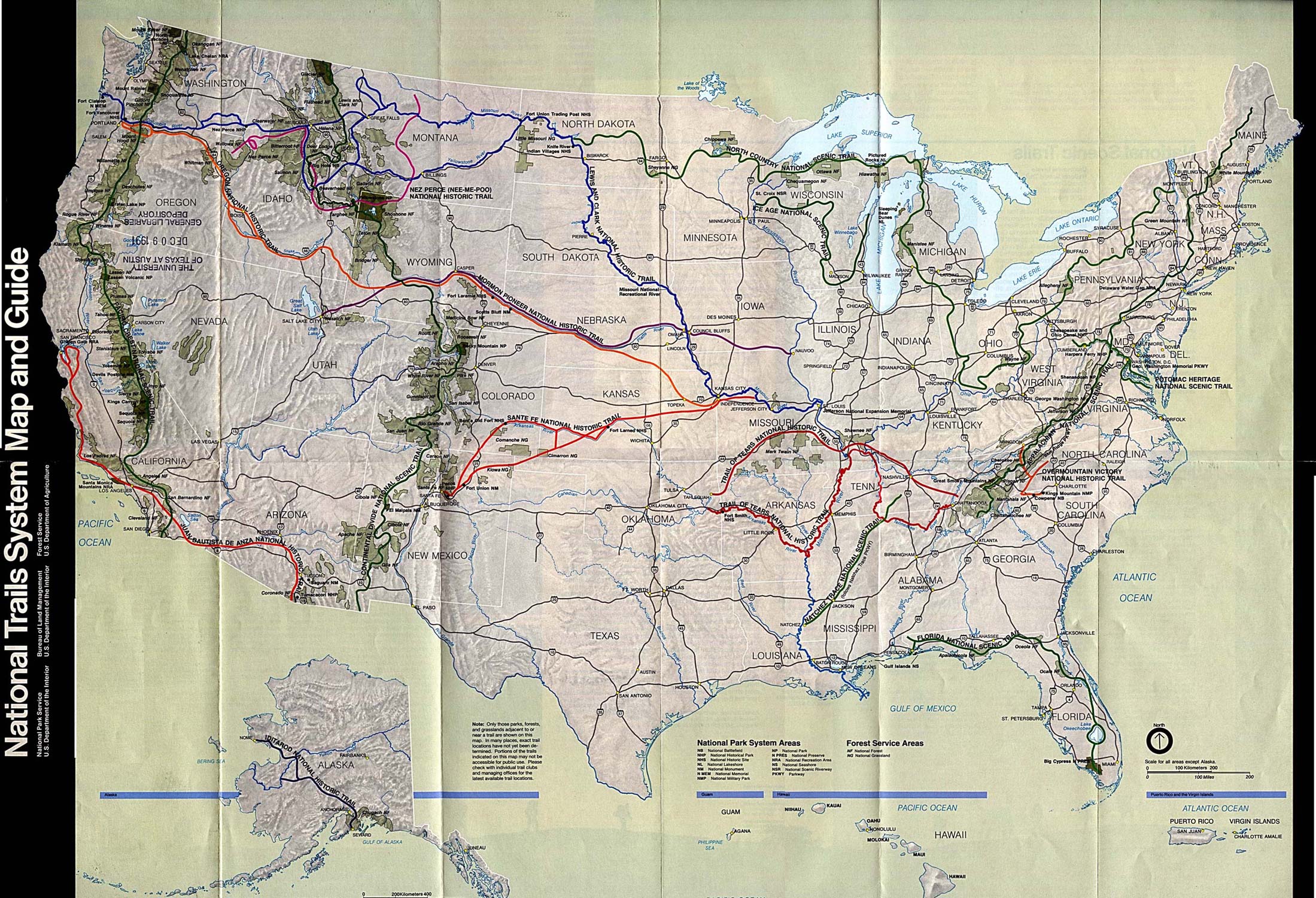
Map of NPS Historic Trails in the United States

Here is a revised itinerary of the west coast trip with the reasons that these parks are chosen:
5/11                Leave Las Cruces on el Camino Real de Tierra Adentro and Santa Fe Trail NHT.    
                      Trails of commerce and conquest during Spanish colonial and U.S. territorial times.
5/12                Bent's Old Fort NHS and Sand Creek Massacre NHS, Colorado. A Santa Fe Trail    
                      trading post and the site of a massacre of Cheyenne and Arapaho by U.S. soldiers.
5/13                Ft. Larned NHS, Kansas. Another U.S. Army post along the Santa Fe Trail.
5/14                Driving to history along the Cimarron Cut-off of the Santa Fe Trail
5/15                Return to Las Cruces

5/26                Leave Las Cruces
5/27                Moab, Utah and Arches NP
5/28                Golden Spike NHS, Utah. The Union Pacific and Central Pacific railroads united the
                        nation here in 1869.
5/29                Gray's Lake National Wildlife Reserve, Idaho. The summer nesting place for the      
                        sandhill cranes who winter near Las Cruces at the Bosque de Apache NWR.
5/30                 Minidoka NHS, Idaho. A World War II Japanese American internment camp.
5/31                 Driving to history   
6/1                   Nez Perce NHP, Idaho. The Nez Perce tried to escape a forced relocation to a
                        reservation on a heroic 1,200 mile march.
6/2                   Hanford (of the Manhattan Project NHP), Washington. Plutonium for the atomic
                        bomb was made here.
6/3                   Driving to history
6/4-7               Klondike Gold Rush NHP, and Mt. Rainier NP, Washington.
6/8                  Lewis and Clark State Park, Washington and Ft. Clatsop NM, Oregon. Lewis and
                        Clark’s Corps of Discovery wintered here in 1805-06.
6/9                   Driving to history
6/10                 Redwoods NP, California. Stands of majestic trees are preserved along the Pacific
                        coast.
6/11                 Driving to history.
6/12-16           Golden Gate National Recreation Area (NRA), Rosie the Riveter/World
                        War II Home Front NHP, Muir Woods, California. The Golden Gate NRA combines
the natural beauty of the Bay Area with the strategic port defended by forts and
armaments. Rosie the Riveter celebrates the women on the Home Front that helped win World War II. Muir Woods is named after the Sage of wilderness.
6/17                Sutter’s Mill, California. Gold, I tell ya, Gold!
6/18-20          Yosemite NP, California. Hello—It’s Yosemite!
6/21-22          Sequoia NP, California. Some of the tallest trees in the country.
6/23                Manzanar NHS, California. Another Japanese American internment camp during
                       World War II
6/24               Driving to History
6/25-26         Grand Canyon NP, Arizona. It’s deep.
6/27               Driving to History
6/28               Casa Grande NM, Arizona. One of the first NM units to protect a pre-contact
                      Native American ruin. Return to Las Cruces, New Mexico.

The Creation of National Parks, National Monuments, and the NPS

To explain the different units in the NPS will take some time, so get comfy. In 1872, Congress created a federal, a National Park at Yellowstone out of the Territories of Montana and Wyoming. Yellowstone set the stage for the today’s Parks that awe us, nurture us, revive us, inspire us, and instruct us about our country. In the twenty years after 1872, Congress approved five more National Parks (NP). These are jewels of the natural world with jagged mountains, majestic trees, and towering granite domes.

In 1906, Congress passed the Antiquities Act which gave the president the power to administratively designate and protect public lands as a National Monument (NM). It allowed presidents “to proclaim and reserve historic landmarks, historic and prehistoric structures, and other objects of historic or scientific interest.”[1] Originally, NMs focused on pre-contact Native American sites.
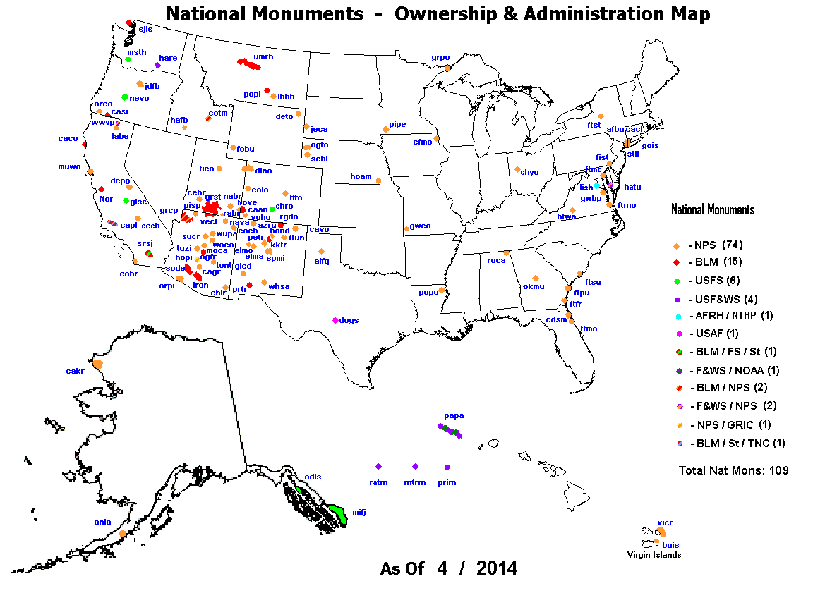
Map of National Monuments in the U.S. and who manages them


In August 1916, Congress passed and President Wilson signed the National Park Service Act which we celebrate this centenary year. The NPS has dramatically changed over the years. What do those acronyms like NHS, NHP, NB, NBP, NST, and PWKY mean? There is little difference between National Historic Sites (NHS) and National Historical Places (NHP). NHS are often smaller than NHP, but not always. National Battlefields (NB), National Battlefield Parks (NBP), and National Military Parks (NMP) honor the sites of combat within our country’s boundaries and on some of the U.S. overseas protectorates. Parkways (PWKY) and National Historic Trails (NHT) mark the historic as well as the scenic transportation networks that spread colonization, conquest, and commerce across the continent. When some people say National Parks, they mean all 410 units of the NPS. Others mean just the special fifty-nine NPs so designated.To find your park, visit:  https://www.nps.gov/findapark/index.htm.

To confuse matters even more, in 1933 a massive consolidation and reorganization occurred under President Franklin Roosevelt. The parks, memorials, battlefields, and monuments previously owned and operated by the War Department, the National Memorials, the National Capital Parks, and the Agriculture Department’s National Monuments joined the NPS system. For more information about the various designations for NPS units, go to:  https://www.nps.gov/goga/planyourvisit/designations.htm

Basically, the NPS has two general types of parks—those that are natural beauties and wonders and those that are culturally or historically significant to our past. National Parks, National Seashores, Scenic Rivers, Wild Rivers, and others preserve nature. National Monuments, National Historical Parks, National Historic Sites, and such units oversee our heritage. For a historian who loves nature, driving to the parks this centenary year brings joy to my heart.

Creating parks, funding parks, presenting parks to the public has often been embroiled in politics and profit. Those who want to utilize the resources of the parks, the lumber, the oil, the grazing rights, and the minerals don’t want anything to obstruct their access. Those who want to preserve the natural and cultural resources for future generations have to fight to create these special units and continue to fight for protection even after they are made.
The Regions of the NPS

On the Road Again

The future Driven by History posts will change. Up to now, the park histories came from research and writing that sometimes took several months. Now I will research and write on the fly and on the drive. Granted, I will be freshly immersed in the places, but still, the blogs will be different. They will be more placed based, and posts will come as I visit them, not in a chronological narrative. In truth, I have no idea what the road writings will turn into. Like life, it’s a work in progress with everyday routines sparked by surprises.

After the west coast trip, I will embark on a longer eastern and southern trip over the fall, visiting more parks, meeting more Americans, and writing. The NPS motto this year is Find Your Park. For me, it is Show Me Your Park. Let me know what your favorite park is. You can reach me at jon.hunner6@gmail.com.
Me and the Beagle at a rest stop above Las Cruces with the Roadrunner Sculpture by Olin Caulk

This is trip is made possible by another great American idea (besides the Declaration of Independence and the National Parks)—public education. Thanks to the History Department at New Mexico State University, especially Dwight, Peter, Mark, Bill, and our chair William Storm. Dwight Pitcaithley as a past chief historian of the NPS has guided my trip in many ways. Thanks to the history students who have helped in this, especially my research assistant Brianna Barcena. Many thanks go to Nancy and Peter, owners of the HMS Beagle, for its use over the Santa Fe Trail. Thanks to Kim, Jim, Beth, John, Cécile, Douglas, Peter W., Stuart, Sabette, and many others who have listened patiently to my zany ideas and helped with this project. Finally, thanks to the people of New Mexico who employ me and who enable me to be driven by history.


[1] Barry Mackintosh, The National Parks: Shaping the System (Harpers Ferry: Harpers Ferry Center, 1991), 15.

Monday, May 2, 2016

Independence Historical Park at Philadelphia, Pennsylvania

Creating the Constitution

Between the Declaration of Independence and the U.S. Constitution, the American Revolution swept through the colonies pitting friends and families against each other. In truth, it was a civil war. We will explore the battles of the War for Independence in future postings, while today we will stay with the Independence Hall and explore the creation of our democracy.

As the war progressed, most people realized that the Articles of Confederation did not work. No state honored all of their federal taxes since there were no penalties. At times, Georgia and New Jersey refused to pay anything. Consequently, the Confederation government lacked the money to pay even the interest on its foreign debt. By 1786, the United States defaulted on its debts from the war as they came due. Changes had to happen.


Constitutional Convention

The Constitutional Convention convened on May 14, 1787 when delegates returned to Independence Hall in Philadelphia to correct the Articles. By mid-June, the delegates switched from revising the existing Articles to creating a totally new type of government. Many issues might have derailed an agreement among the diverse and divisive states:  how much power to give the federal government; how to elect representatives to Congress and how many should come from each state; who could vote; when to hold elections; and how to change the constitution and thus the government? Delegates debated all of these issues and more through the summer of 1787 in the State House.

In seeking a better government, Americans turned again to the Enlightenment philosophies of the Englishman John Locke, the Frenchman Montesquieu, and other Europeans. Conceding that humans were corruptible and lusted after power, these philosophers did not count on the goodwill of humans to temper our excesses. As Virginian James Madison observed: “if humans were angels, no government would be necessary.”  Despite creating a democracy to give the public power over government, our country’s founders did not truly trust people.
James Madison, delegate from Virginia (Courtesy http://www.biography.com/)
To counter human nature, the delegates turned to Montesquieu who championed the separation of power between the executive, legislative, and judicial branches to protect individual freedoms. Only power checking power could preserve the hard won liberty. Such borrowings from enlightenment thought found fertile ground in the deliberations to revise the Articles of Confederation.


Virginia versus New Jersey

The convention debated two models of democracy —the Virginia Plan and the New Jersey Plan. The Virginia Plan, written mainly by James Madison, favored empowering the states with the larger populations. It proposed a federal government with three branches to insure checks and balances to prevent abuses of power. The legislative branch had two houses—one elected by popular vote for three year terms and the other selected by state legislatures for seven year terms. Representation was based on population – larger states had more elected officials in both chambers.     

The New Jersey Plan, also known as the Small State Plan, challenged the Virginia Plan when William Paterson presented it to the Constitutional Convention on June 15, 1787.  To counter the disproportionate power that the more populated states would garner under the Virginia Plan, this alternative called for a unicameral body with one vote for each state like under the Articles of Confederation. In a compromise cobbled together by the Connecticut contingent, aspects of the New Jersey Plan were incorporated into the final draft. This created a bicameral legislature with a House of Representatives apportioned by population and a Senate which granted equal votes to each state, big or small.

After debate and compromise carried out over the summer, the Constitutional Convention adopted the new Constitution on September 17, 1787 and sent it out from Independence Hall to the states for approval. Ratified by conventions in eleven States, the Constitution went into effect on March 4, 1789. As the supreme law of the land, the Constitution formed a model for representative government that launched a democratic revolution around the world over the next two centuries.
The Preamble of the U.S. Constitution
The Constitution created three units of the federal government—an elected bicameral legislature, an elected president in charge of the executive branch, and an appointed judicial system. All three have duties to ensure a separation of powers to safeguard against abuses. For sharing power between the federal government and the states, national laws take precedence, but funding flows to the states. Finally, the Constitution describes how to ratify it and how to amend it.

The Constitution paradoxically empowers and protects citizens from the entrenched interests of the economically and politically powerful while at the same shielding those elite interests from power of the people. Checks and balances do minimize the abuse of power by our leaders as well as the same by the many. Our founding fathers did not fully trust the American people, both the wealthy as well as the rest of us to do the right thing.
"Scene at the Signing of the Constitution of the United  States" by Howard Chander Christy

Democracy as a blood sport

From the beginning, political combat between opposing forces has shaped our society. That is the history that drives us and our culture. Some of our citizens embrace  personal liberties so much that they want little or no regulation on individual and corporate activities. This group feels threatened by government. Others support government in regulating the excesses of the powerful. Who does the most to protect our freedoms—people in business or people in government? As part of the government that regulates and protects, the NPS serves on the front lines of this basic battle of what to save and what to use in our land.

This plays out in interesting ways. Story of AZ who thought he owned the Grand Canyon.
The Constitution provided the framework for the success of our republic. It held many firsts as historian Joseph Ellis states:  it established the first modern nation sized republic; it created the first wholly secular nation; and it created a government with overlapping agencies where multiple states and their divergent interests worked together. Despite the strengths of the Constitution, the Founding Fathers avoided several areas which belied the phrase that all men are created equal. For a nation created on equality, slavery existed and in the coming century, grew in some states and territories. Native Americans did not receive equal protection and in fact, lost land and rights. Women did not win the right to vote until the 20th century. While the Constitution serves as a model for democratic governance around the world, it also held some almost fatal flaws as well. 


Sacred Space at Independence Hall.

The colonial men and women had fought a long and difficult war to free themselves from King George and the Parliament. Some of the plans and justifying documents came from Independence Hall in Philadelphia. As the war ended and the new country struggled to create a government acceptable to the all of the states, the hall once again hosted the intense debates and the drafting of the new republic. The resultant Constitution of the United States has for more than two centuries served as a model for democratic governments around the world.

From May 1775 to 1783, Independence Hall served as the principal meeting place for the Second Continental Congress and from 1790 to 1800 was the temporary capital of the new country. The newly formed Congress and recently elected President Washington conducted their business next door in the Congress Hall as the nation’s permanent capital was built south of Philadelphia on the Potomac River.

At first, Independence Hall and the surrounding buildings that had played such a vital role in the Revolution and forming of the Republic did not attract much public attention. In the 1820s, one room in the State House was designated as Independence Hall and the surrounding block as Independence Square. A first floor museum opened in 1876, and the second floor restored in 1897. On June 28, 1948, the U.S. Congress authorized the Independence National Historical Park which was then formally established on July 4, 1956. Independence Hall became a UNESCO World Heritage Site on October 23, 1979. The area around Independence Hall is sacred ground for democracy.

Millions of people from around the world have converged on Philadelphia, have tramped over the grassy mall, lined up to view the Liberty Bell, toured Independence Hall and the Portrait Gallery, and visited the other sites of this National Historical Park. They all come to look for America.
People lined up to view the Liberty Bell (Photo by Hunner)

Independence National Historical Park
143 South Third Street
Philadelphia, PA 19106
(215) 965-2305

http://www.nps.gov/inde/index.htm

Monday, April 25, 2016

Independence National Historical Park at Philadelphia, Pennsylvania

Philadelphia at the Center of Revolution

We trick ourselves by thinking that the past had to happen the way it did, into thinking that the American Revolution was inevitable. Totally different results and consequences could have spun out of it. Indeed, the colonials argued among themselves about rebellion. About 1/3rd of them, the colonial Tories, stood by Britain. Another 1/3rd, the Patriots, sought independence, and a rest of them remained neutral. Like today, disagreements about politics and change tore apart families and communities up and down the Atlantic seaboard. Much of the intellectual fervor centered in Philadelphia.

Philadelphia nurtured a yeasty think tank for rebellion and democracy as debates rang through the streets, meeting rooms, and taverns. From the beginning, Philadelphia attracted political thinkers and then hosted the delegates who invented a revolutionary government. Ancient Greek and Enlightenment philosophers inspired the colonials to revolt and to create a new form of government. At Philadelphia, the intellectual reasons and emotional appeals for the rebellion and establishment of a democracy flourished.

A unique colony, Philadelphia was founded for religious freedom and tolerance. Given by King Charles II in 1682 to Quaker William Penn and his Friends, Philadelphia quickly thrived as a business and intellectual center for the colonies. Its lively port, its central location between the north and south colonies, its gateway to the productive western lands, and its embrace of the many peoples who flocked there created a vibrancy that anchored the tumult of the second half of the 18th century.

It was one thing for rebels in Massachusetts to start shooting at the Redcoats. It was another thing altogether for a new Congress to fund and prosecute a revolution while governing on the fly. Much of the debate and planning happened in Philadelphia’s Pennsylvania State House, now known as Independence Hall. Some of the most important moments in the founding of our republic occurred at this State House. The drafting of the Declaration of Independence in 1775, organizing the army, and then the creation of the Constitution in 1787-1788 all took place here. Philadelphia held a unique position for the rebellion and the nascent republic. Actions taken there drive us to ourselves today.
Independence Hall in Philadelphia (Photo by Hunner)

The Continental Congresses

Responding to the Intolerable Acts which punished Boston for its Tea Party, Benjamin Franklin called for the First Continental Congress to meet at the Carpenters’ Hall in Philadelphia beginning September 5, 1774. This Congress issued a “Declaration and Resolves of the First Congress” which declared “That the foundation of English liberty, and of all free government, is a right in the people to participate in their legislative council.”[1] Although a birthright for Englishmen, political representation remained elusive for the colonials. To force the issue with Parliament, the First Continental Congress called for the boycott of British goods and for communities to form committees to monitor compliance. These grass roots units served as the organizational and communication network that bound the disparate colonies together. With these and other actions, the First Continental Congress disbanded in October 1774. Several months later, the American Revolutionary War erupted around Boston (as described in the previous posting on the Minute Man National Historical Park). War dramatically altered the next congress.
Benjamin Franklin as shown at the Portrait Gallery in Independence
National Historical Park (Photo by Hunner)

The Second Continental Congress convened on May 19, 1775 at the Pennsylvania State House. The State House, built in the 1730s, served as a seat of government first for the colony and then for the Revolution. This Congress sent the Olive Branch Petition to King George III proclaiming American loyalty to Britain, which the king rejected. Instead, the King declared that the colonies were in revolt and ordered his army in Boston to treat the colonials as “open and avowed enemies.” Not surprisingly, this poured fuel on the revolutionary fire.

In anticipation of a growing conflict, the Second Congress created the Continental Army on June 14 with Virginia delegate George Washington its commander-in-chief. Congress chose Washington because he had distinguished himself as a military leader in the French and Indian War and because Virginia played a leadership role in the revolt. From Philadelphia, Washington wrote to his wife Martha: “It has been determined in Congress that the whole army raised for the defense of the American cause shall be put under my Care, and that it is necessary for me to proceed immediately to Boston to take upon me the command of it.”[2] He rushed north to Boston.
George Washington at Portrait Gallery (Photo
by Hunner)
Martha Washington at Portrait Gallery (Photo
by Hunner)


Congress in the spring of 1776 defiantly moved to declare independence, to seek foreign allies, and to unite the colonies in North America. A “Committee of Five” led by Thomas Jefferson drafted a resolution which the Congress debated in a stifling June heat wave.

The Declaration of Independence

In contrast to European governments, the Declaration proclaimed that “all people are created equal,” that governments derived their “just Powers from the consent of the people,” and that people needed to “alter or abolish” a government which curtailed their rights. After establishing the natural and legal rights of people to seek freedom from an unjust government, the rest of the Declaration listed twenty-seven specific abuses perpetrated by the King and Parliament against the colonies.

Fifty-seven representatives from all thirteen colonies signed the Declaration of Independence in the Assembly Room of the Pennsylvania State House on July 4, 1776. The declaration launched our democracy and has inspired people from around the world with its call for equality and freedom; however written by slave owners and devoid of a woman author or signer, this call for liberty and freedom is still a work in progress.
Declaration of Independence fro the British colonies (http://www.founding.com/repository/imgLib/20071018_declaration.jpg)
Over the years, people from Wallace Stegner to Ken Burns have called the National Park Service “American’s Best Idea.” Former NPS chief historian Dwight Pitcaithley disagrees: “Is it really the best idea we ever had of all the ideas in this democracy? It seems to me that Thomas Jefferson’s 2nd paragraph in the Declaration of Independence: ‘We hold these truths to be self-evident, that all men are created equal and are endowed by their creator with certain unalienable rights, such as life, liberty, and the pursuit of happiness’ is really the best idea we ever had.”[3] As good as our Parks are, this best idea took shape at Independence Hall in 1776.

Visitors to Independence National Historical Park today wait in long lines to view the Liberty Bell. This cherished symbol of American Independence was cast in 1752 in England with the legend “Proclaim LIBERTY throughout all the land unto all the inhabitants thereof.” The bell often summoned lawmakers to legislative sessions. To mark the reading of the Declaration of Independence on July 8th, the Liberty Bell rang in the State House tower.

Although the delegates from the colonies agreed on the Declaration, it needed public support as well. To help rally Virginians to the cause of independence, Patrick Henry gave a rousing speech to the House of Burgess in Richmond. Complaining about British soldiers on American soil, Henry posed: “They are sent over to bind and rivet upon us those chains which the British ministry have been so long forging…. We have done everything that could be done to avert the storm which is now coming on…. Three million of people, armed in the holy cause of liberty, and in such a country as that which we possess, are invincible by any force which our enemy can send against us.” Henry concluded: “I know not what course others may take, but as for me, give me liberty, or give me death.”[4] With such rousing orations, public support for the rebellion rose. 
Patrick Henry calling for revolution
(http://dailysignal.com/wp-content/uploads/150323_HenrySpeech.jpg)
In the winter of 1776 and again in the fall of 1777, Congress retreated from advancing Redcoats and abandoned Philadelphia for Baltimore. Threatened by hostile forces, Congress continued to draft the “Articles of Confederation and Perpetual Union” amid the chaos of war.

The Articles of Confederation

The debate on what type of national government to create pitted populous states against smaller ones, northern against southern states, and those who favored a strong national government versus those who wanted a weak one. The smaller states prevailed on representation as each state got one vote in the Confederation. When Congress forwarded the Articles to the colonies, Virginia ratified it first on December 16, 1777 while Maryland approved it last on February 2, 1781. As the Revolutionary War waged across the colonies, Congress struggled to finance the war with borrowed money.
Front page of the Articles of Confederation (Courtesy Library of Congress)
The Articles established the rules and duties for the national government which included prosecuting war and seeking peace, negotiating diplomatic and trade agreements, and settling disputes between states. However, it was obvious that the Articles did not work. They did not give the national government the power to raise money through taxes. No state honored all of their financial obligations, and at times, Georgia and New Jersey refused to pay anything. Consequently, the Confederation government had little money to pay even the interest on its foreign debt. By 1786, the United States was defaulting on its debts as they came due. Changes had to happen. The resultant creation of the Constitution of the United States at Independence Hall in 1787 is next week’s posting.

Congress designated Independence Hall a National Historic Site in 1943 followed by National Historical Park status in 1948. The following sites are some, but not all, of the buildings that comprise the Independence National Historical Park:
Independence Visitor Center - 525 Market Street
Independence Hall - 520 Chestnut Street
Liberty Bell Center - 526 Market Street
Portrait Gallery- 420 Chestnut Street
City Tavern - 138 S. 2nd Street
Park Headquarters - 143 S. 3rd Street

Millions of people from around the world have driven through Philadelphia, stood in line to view the Liberty Bell, toured Independence Hall and the Portrait Gallery, and visited the other sites of this National Historical Park.

Its history drives us.

Driving by Independence Hall (Photo by Hunner)
Independence National Historical Park
143 South Third Street
Philadelphia, PA 19106
(215) 965-2305
http://www.nps.gov/inde/index.htm


[1] Bruun and Crosby, Our Nation’s Archive, 116.
[2] Kelly, Best Stories of American Revolution, 85.
[3] Interview of Dwight Pitcaithley by Jon Hunner for Storycorps, Jan. 6, 2016 in Las Cruces, NM.
[4] Bruun and Crosby, Our Nation’s Archive, 118-19.

Monday, April 18, 2016

Minute Man National Historical Park at Concord, Massachusetts

“The Redcoats are Coming!”

“Lay down your arms, ye damned rebels, lay down your arms!” With that terse command from Major Pitcairn of the British Army, his guard of 150 soldiers confronted the 77 assembled Minute Men on the town green at Lexington, Massachusetts. On April 19, 1775, the battles at Lexington and Concord launched the Revolutionary War which led to American independence and created a freedom movement and a form of government that changed the world.

The militia on the Lexington Green that morning had responded to the alarms spread by Paul Revere, William Dawes, and Dr. Samuel Prescott. At the time, no one cried “the British are Coming!” Most colonials still considered themselves British. The cry that did ring through the New England countryside was “The Redcoats are Coming!”

Route the Redcoats took to Concord from Lexington (NPS map)
The opposing sides on the Lexington Green fired at each other, and then the British soldiers charged with bayonets, killing eight and wounding ten. The Redcoats suffered no casualties. The colonial militia scattered, and Pitcairn rushed his men to Concord to capture rebel arms and ammunition.
A re-enactment of the Battle of Lexington Green (http://www.lexingtonminutemen.com/)
The battles at Lexington and Concord that April in 1775 sparked the American Revolutionary War. Administering the American colonies burdened the growing British world empire, and Parliament wanted income. Beginning in 1733 with the Molasses Act and increasing after the costly French and Indian War (1754-1763), taxes on essential colonial products raised the ire of the Americans. The First Lord of the Treasury, George Grenville, justified the taxes saying that they would go “toward defraying the necessary expenses of defending, protecting, and securing the said colonies and plantations.” From our early days, taxes have vexed Americans.

The Road to Rebellion

A particularly odious tax on the colonies was the Stamp Act of 1765. It required revenue stamps on newspapers and most printed material, even playing cards. Thus, the Stamp Act angered the influential people who shaped public opinion—the newspaper editors, lawyers, and tavern owners. As a result, open acts of rebellion flared, including the sacking of the Bostonian homes of the Lt. Gov. Thomas Hutchinson and his brother-in-law Andrew Oliver, a stamp act commissioner. In response, the British sent troops to Boston to quell the growing rebellion.

The stamp required for all printed materials from the act of 1765.
Grenville also imposed the Quartering Act in 1765 which required the colonies to supply British soldiers with food and housing. Since the major British force resided in New York, this hit that city particularly hard. More controversial acts followed, adding fuel to the fire. Local Sons of Liberty began to organize against the rising “tyranny” of the British over colonial matters.

Revolutions need many elements to succeed. They need a perceived threat to motivate people to rebel. They need talented leaders to take charge and figure out how to rebel. They require a network of communication to spread the word. And they need luck.

Talented writers fanned the flames of rebellion and justified the challenge to the British and King George III. Virginians Patrick Henry and John Dickinson, Pennsylvanian Benjamin Franklin, and Bostonian Samuel Adams stoked popular resentment with pamphlets, broadsheets, and articles decrying British rule and rallying the public with slogans such as “No taxation without representation,” and “Give me Liberty  or give me Death.” From leaflets to popular songs sung in taverns, the rebels organized against England.  

Building on the growing discontent, rebels started boycotting British imports. Sassafras tea replaced British tea as the protestors’ drink of choice. Women made garments out of homespun cloth, merging fashion with defiance. Patriots organized militia to resist England. In Massachusetts, almost all men between sixteen and sixty served in their town’s militia, nicknamed Minute Men. Such units mustered for drills that included weapons’ training and rapid responses to any threat to their communities. They knew that if open rebellion occurred, the Patriots would face the best military in the world.

The Boston Massacre and Tea Party

As tensions rose, violence erupted. On March 5, 1770, a lone British sentry in front of the customs house at Boston cried out as a group of youths pelted him with snowballs. Reinforcements poured out of the nearby barracks and tussled with the gathering crowd. A British solder fired, then more shots rang out, killing five and wounding another eight. Ironically, the first person killed in the fight for American independence was the African-American Crispus Attucks, a runaway slave who worked on the ships in the harbor. With these martyrs to the cause of rebellion, the Boston Massacre escalated the conflict.

On December 16, 1773, a group of men disguised as Mohawk Indians stormed three ships in the Boston harbor and dumped 342 chests of tea into the frigid waters to protest the taxes.  Parliament punished Boston with the Coercive Acts, aka the Intolerable Acts, which closed the port until the equivalent of $90,000 in today’s dollars was paid for the tea. Other punitive acts followed which forced Bostonians to house the Redcoats without recompense. Public assemblies could only happen with the approval of the governor, Gen. Thomas Gage. The British military now ruled Massachusetts. In reaction, Benjamin Franklin called for the First Continental Congress to assemble in Philadelphia. We will take up this part of the revolutionary story in the next chapter on the Independence National Historical Park.
Sons of Liberty tossing crates of imported tea into the Boston Harbor (http://www.history.com/)
What did the rebels want? They fought for independence from an oppressive regime; for equality (for white males with property); and for representation in government. Newly arrived from England, Thomas Paine published the influential Common Sense in January 1776. In it, he wrote:

It is not in the power of Britain to do this continent justice: … for if they cannot conquer us, they cannot govern us.… Independency means no more, than, whether we shall make our own laws, or, whether the king, the greatest enemy this continent hath, or can have, shall tell us, "there shall be no laws but such as I like.”

Cries for rebellion like Payne’s unified the disparate colonies into a continent, into a whole land. Granted, the thin line of English settlement along the eastern seaboard ignored the rest of North America; nonetheless, colonials started seeing themselves as part of a larger whole fighting against a corrupt government.

The Battles of Lexington, Concord, and Bunker Hill

Revolt ignited that April morning north of Boston. After the British attacked the militia at Lexington Green, they continued to Concord. Neighboring Minute Men swarmed to the sporadic gunfire as the Redcoats searched for arms and ammunition. When the militia saw smoke coming from Concord, they feared that the British had started to torch the town. They charged the North Bridge occupied by the Redcoats and exchanged fire which killed two Patriots (the first causality from nearby Acton) and eleven English soldiers. Colonel Francis Smith ordered his men to retreat to Boston.
Minute Men re-enactors crossing the North Bridge (NPS photo)
A mile east of Concord at Meriam’s Corner, a narrow bridge across a creek created a bottleneck for the retreat, and Minute Men, hiding behind fences, walls, and trees, started picking off the enemy. More militia joined the fray and forced the English to run a gauntlet of deadly gunfire as they retreated to Boston. Near Lexington, the British column faced the militia they had attacked that morning who exacted retribution from the Redcoats. A British officer wrote about their retreat:

The Rebels kept the road always lined and a very hot fire on us without intermission; we at first kept our order and returned their fire… but when we arrived a mile from Lexington, our ammunition began to fail and … so that we began to run rather than retreat in order.[1]

Inconceivably, the ragtag group of colonial militia had forced the Redcoats to flee in disorder.

After the first skirmishes at Lexington and Concord in April 1775, conflicts erupted at Fort Ticonderoga and Crown Point in New York. On June 17, militia from the Boston area defended the strategic heights above Charlestown from a Redcoat assault. During the Battle of Bunker Hill, a first wave of over 2,000 Redcoats struggled uphill over fences and hastily constructed bulwarks. Volleys of bullets rained down from above and forced the Redcoats to retreat. They charged again, and again the militia fought them back. The third charge proved successful as the rebels started to run out of ammunition. The British suffered 1,054 casualties including 232 dead while the Americans had only 400 dead, wounded, or missing. British General Clinton complained: “A dear bought victory—another such would have ruined us.”
Map of Bunker and Breed's Hills  


The British Regulars at the Battle of Bunker Hill 

The Impact of the Boston Battles

Several consequences came out of these first armed clashes. First, with cold weather approaching and surrounded by the Continental Army, the British abandoned Boston and retreated by boat to Halifax, Canada where they wintered. Second, the British generals became more cautious in engaging the home grown militias whose atypical combat style proved effective. Third, the Continental Congress called for all able bodied men to join the militia; however, not everyone supported the rebellion. Perhaps a third of the colonials wanted rebellion and freedom from England while another third remained loyal to the king. The rest stayed neutral. The call to enlist in the army and indeed, the war itself split families and communities into divided camps of Patriots and Loyalists. Finally, these Boston battles sparked the years of war, of combat, and of destruction as armies marched across countrysides, killing one another, and often destroying what lay in their paths.

The American Revolution, begun in April 1775 in Concord, lasted until the Battle of Yorktown in Virginia in October 1781. We will explore the history of the war in the following chapters.

The Minute Man National Historical Park was created on September 21, 1959 when President Eisenhower signed its enabling act.

Minute Man National Historical Park
174 Liberty Street
Concord, MA  01742
978/369.6993


[1] Stevens, America’s National Battlefield Parks, 25.

Monday, April 11, 2016

Rest Stop in New Mexico

Rest Stop #1 off the highway of history

Before we move from the Colonial to the Revolutionary War period, now is a good time to pull into a rest stop and take a break from the histories of the Parks. Let’s talk about my upcoming road trip. In mid-May, I hit the road, visit our Parks, and continue to write about the history of the United States through the lens of the National Parks. Later in this post, you will see the tentative itinerary of my west coast travels.

My trusty ship for part of the western part of my travels is the HMS Beagle, a twenty-four foot Winnebago that my trusting friends Nancy and Peter are letting me use. Here’s several photos of it on a shake-down cruise in the mountains of southern New Mexico in April.
To the left is the HMS Beagle on the road to the Gila Cliff Dwellings. Below is the Beagle at Faywood Hot Springs on the shakedown cruise. Of course, it is named after Darwin's ship which carried him to a new understanding of our world.

The Beagle is a sweet ride. This mini-home has a kitchen, bedroom, bathroom, and a table where I can write while looking out into our National Parks. Throughout my journeys, I will camp in the heart of our Parks and as John Muir suggested, I will undergo a transformation in such landscapes within the NPS:
“… your baptisms will make you a new creature indeed…. Here will your soul breathe deep and free in God’s shoreless atmosphere of beauty and love.” Thanks to Nancy and Peter (who like Darwin are intrepid explorers of our world and our peoples) for helping make part of the western road trip possible with this wonderful loan of the Beagle.

I am glad to have wheels like the Beagle because I am driven by the past. The past surrounds us, guides us in life choices, entertains us, helps prepare us for the future, and cements our legacy with our descendants. Our pasts create us and drive us. Everyday, people get high on the past —with family and friends, on visits to historic places, in classrooms, and through a variety of means. It is part of the human condition.

To understand any people and any country, go to the source. Go to the places where events happened that formed and transformed a people and a nation. In the United States, the NPS preserves many of those significant places. I will visit these places where such events actually happened and use those specific places as a spring board to write a history of the U.S. To understand the U.S., I also look forward to meeting a wide variety of people in the Parks and along the way.

So here’s the deal. As soon as I finish up my teaching this spring at New Mexico State University, I will head out. As you can see with the Westward Trip itinerary below, I will drive through a lot of western history along historic trails from Kansas to the Pacific Coast and then back to New Mexico.

Here is the itinerary of the west coast trip with the reasons that these parks are chosen:
5/11                Leave Las Cruces, New Mexico on El Camino Real de Tierra Adentro and Santa Fe
                      Trail NHT.  
                      Trails of commerce and conquest during Spanish colonial and U.S. territorial times.
5/12                Bent's Old Fort NHS and Sand Creek Massacre NHS, Colorado. A Santa Fe Trail  
                      trading post and the site of a massacre of Cheyenne and Arapaho by U.S. soldiers.
5/13                Ft. Larned NHS, Kansas. Another U.S. Army post along the Santa Fe Trail.
5/14                Driving to history along the Cimarron Cut-off of the Santa Fe Trail
5/15                Return to Las Cruces

5/26                Leave Las Cruces
5/27                Moab, Utah and Arches NP
5/28                Golden Spike NHS, Utah. The Union Pacific and Central Pacific railroads united the
                        nation here in 1869.
5/29                Gray's Lake National Wildlife Reserve, Idaho. The summer nesting place for the    
                        sandhill cranes who winter near Las Cruces at the Bosque de Apache NWR.
5/30                 Minidoka NHS, Idaho. A World War II Japanese American internment camp.
5/31                 Driving to history   
6/1                   Nez Perce NHP, Idaho. The Nez Perce tried to escape a forced relocation to a
                        reservation on a heroic 1,200 mile march.
6/2                   Hanford (of the Manhattan Project NHP), Washington. Plutonium for the atomic
                        bomb was made here.
6/3                   Driving to history
6/4-7               Klondike Gold Rush NHP, and Mt. Rainier NP, Washington.
6/8                  Lewis and Clark State Park, Washington and Ft. Clatsop NM, Oregon. Lewis and
                        Clark’s Corps of Discovery wintered here in 1805-06.
6/9                   Driving to history
6/10                 Redwoods NP, California. Stands of majestic trees are preserved along the Pacific
                        coast.
6/11                 Driving to history.
6/12-16           Golden Gate National Recreation Area (NRA), Rosie the Riveter/World
                        War II Home Front NHP, Muir Woods, California. The Golden Gate NRA combines
the natural beauty of the Bay Area with the strategic port defended by forts and
armaments. Rosie the Riveter celebrates the women on the Home Front that helped win World War II. Muir Woods is named after the Sage of wilderness.
6/17                Sutter’s Mill, California. Gold, I tell ya, Gold!
6/18-20          Yosemite NP, California. Hello—It’s Yosemite!
6/21-22          Sequoia NP, California. Some of the tallest trees in the country.
6/23                Manzanar NHS, California. Another Japanese American internment camp during
                       World War II
6/24               Driving to History
6/25-26         Grand Canyon NP, Arizona. It’s deep.
6/27               Driving to History
6/28               Casa Grande NM, Arizona. One of the first NM units to protect a pre-contact
                      Native American ruin. Return to Las Cruces, New Mexico.

The motto for the NPS this centenary year is “Find Your Park.” My motto is “Show Me your Historic Park.” Yes, I know, not quite as snappy, but check out the itinerary and let me know where your favorite Park is.

You might ask what qualifications I have to undertake this National Park road trip. I claim three essential skills. First, I do the past. Second, I used to be a truck driver. And third, I am a fool.

I do the past. I research it, preserve it, interpret it, and present it.  I have taught history for over two decades at New Mexico State University. I teach 20th century U.S. history and Public History-- where I train graduate students who want to work as historians in museum, archives, and National Parks. I have several books to my name, including Inventing Los Alamos and J. Robert Oppenheimer, the Cold War, and the Atomic West. 

Since January, my graduate student assistant Brianna Barcena and I have compiled notebooks of information on the Parks that I will visit. Thanks Brianna for your diligent research. Using these detailed notebooks when I hit the road, I also will explore the parks by visiting their exhibits and libraries and by encountering their landscapes on foot, on a bike, and by vehicles.  I will then write histories like those already posted on Driven by History. When my journey ends at the New Years, I will return to my engaged students at NMSU. Back in Las Cruces, I will rework my blogs and revisit my Park and road trip experiences to continue to write a history of the United States using the places and people that made our country.

My second qualification-- I like to drive. I ran an art transport business in the 1980s when some years, I drove 60,000 miles. I still like rolling up the miles charging down a highway through a changing landscape. I like experiencing both our magnificent land as well as our many peoples. I anticipate meeting places and people who will show me the many and varied truths of our country. I like driving into the past, exploring who we are and who we want to be. 

Lastly, let me take a sober moment for full disclosure. I am now a professor, but I have a checkered past. I clown around. To do a road trip like this through our Parks, I have to be a fool. I have done so my whole life. I unfortunately mimed at a football game in Chama, New Mexico where I also almost lost my life as a clueless rodeo clown, I did street theater on the Santa Fe plaza as the Juggling Fool, I performed with a comedy group called Rimshot (whose claim to fame was the punk rock song “My Life is an Open Wound, Come on Baby, Infect It”), and I ran for vice president in 1980 as Stupid Ludd. Foolishness feeds me, and humor nurtures me.

Me and Rachel Trueblood at the NM State Fair
in 1973
Perhaps my height of foolishness occurred in 1976, when to celebrate our nation’s 200th birthday, I walked and juggled from Santa Fe to Albuquerque, about a seventy mile trek. I was an ok juggler with some good patter, but in truth, crazy projects like the Juggling Walk fulfill me. So Driven by History animates the fool in me. It sustains my belief in our world, and for me, laughter is the best medicine for our times. I know this road trip is foolish, just so you know I know.


N.M. Gov. Jerry Apodaca with Arthritis sufferer Kenneth Smith Jr.
and the Juggling Fool publicizing the Juggling Walk against
Arthritis in 1976. (Photo from Santa Fe New Mexican) 


As a historian, a road tripper, and a fool, I offer you a drive into our pasts and a window into our nation’s present through places that I love, our National Parks.

I just thought you might like to know where we are going, who is piloting this journey, and invite you to join me on the road trip. 

Next week, we merge from our rest stop back onto the main highway of history, back to our National Parks and in particular, to the "Shot Heard ‘Round the World."


Walking and juggling 70 miles to support the Arthritis Foundation and celebrate the U.S. bi-centennial in 1976.
(Photo from the Santa Fe Reporter, May 1976)

Monday, April 4, 2016

Grand Portage National Monument at Grand Portage, Minnesota

The Far North 

The Grand Portage was the Grand Central Station of the Native Far North. Long before French colonial coureurs des bois (runners of the woods) entered the region, the Algonquin hauled their canoes and goods over the 8 mile trail around the falls on the Pigeon River. At this site on the northwest lip of Lake Superior, people in canoes traveled to the Atlantic, Pacific, and Arctic Oceans with portages past unnavigable rivers lasting at most a day.

The Ojibwe, an Algonquin speaking tribe, made this land home. Before contact with the French, they trapped, fished, hunted, farmed, and gathered food and resources, moving seasonally to reap nature’s harvest. The Ojibwe used birch bark canoes for fishing, harvesting wild rice, and perhaps most importantly, transporting copper from Isle Royale and furs from their forests for trade with tribes far and wide. 
Birch Bark Canoe in front of the trading post at Grand Portage (Photo by Gary Alan Nelson)
Writing about these canoes, the French missionary Rene de Brehant de Galinese observed in 1669: “The convenience of these canoes is great in these waters, full of cataracts or waterfalls, and rapids through which it is impossible to take any boat. When you reach them, you load canoe and baggage upon your shoulders and go overland until the navigation is good….”[1]
Canoe Manned by Voyageurs Passing a Waterfall by Frances Anne Hopkins (Courtesy Wikimedia Commons)
At such a busy center for travel and trade, Grand Portage served as a gateway for migration, contact, and commerce. Native Americans used it in their extensive trading networks, and during colonial times, the French accessed the interiors of North America through this portage.

 The French Enter North America

The French brought a unique European culture into the hemisphere. They founded over a dozen colonies on Caribbean Islands and also settled Quebec, Montreal, Detroit, Green Bay, and farther south St. Louis, Mobile, Biloxi, Baton Rouge, and New Orleans. In 1608, Samuel de Champlain established the first permanent French settlement in North America at Quebec, the capital of New France. During the early colonial period, the French explored and laid claim to much of the northern and middle parts of North America.

The coureurs interacted with the native peoples differently. French men often married into native communities, raised families, and served as cultural brokers as Europeans spread into tribal ancestral lands. Additionally, while predominantly Catholic, the French did not evangelize with the same zeal as the Spanish nor the English.

Perhaps the first Europeans to arrive at the Grand Portage were Pierre Esprit and his brother-in-law, Medard Chouart, who traveled the area around 1660. A Jesuit missionary, Father Claude Allouez, canoed Lake Superior in 1667 and on his 1670 map of his explorations marked the mouth of the Pigeon River. Then in 1682, René-Robert Cavelier sailed down the Mississippi River and claimed the middle part of the continent for the French, from the upper Rocky Mountains to the Appalachian Mountains. At the edges of these contested empires, disputes flared that sometimes erupted into conflict.

The American Fur Trade

The height of the French fur trade that flowed through Grand Portage occurred between 1740 and 1745. By the late 1760s, English fur traders encroached on the French territories. In 1767, the English traded goods with Native Americans valued at 5,000 pounds sterling and returned the next summer with 100 canoes crammed with pelts. Captain Jonathan Carver witnessed the bounty that summer as packages of pelts came down the trail to the depot and put on larger canoes for transport to Montreal and then to hat makers in Europe. Among the Europeans at the post, Carver also saw Ojibwe, Cree, and Assiniboine tribal members.

The French traded for the pelts of beaver, minx, fox, otter, buffalo, and other animals.  These pelts made hats that were strong, waterproof, and held their shapes. In a damp cool climate of northern Europe with scant heating, beaver hats provided warmth. In the 17th and 18th centuries, beaver pelts made the highest quality hats. For almost two centuries, the Americas provided the raw material for high fashion in Europe. Over the first 2/3rds of the 18th century, English factories alone made approximately 21,000,000 high quality beaver and felt hats from American furs.

The Grand Portage around the Upper Falls on the Pigeon River

Map of the portage around the falls of the Pigeon River (Courtesy Wikimedia Commons)
To get the furs to Europe from middle America, canoes piled to the gunwales sliced through the waters. At unnavigable sections of rivers, coureurs carried their goods and canoes around the obstacles. For the Grand Portage around the falls of the Pigeon River, each porter’s load weighed between 160 and 200 pounds. By stooping over and distributing this heavy load onto the lower and upper back, porters lugged their goods and canoes over the eight miles of the Grand Portage.\
At Grand Portage, an annual rendezvous occurred each July when trappers came from all over to trade their year’s haul, buy supplies for the next year, and party. Some years, 500 men from the fur companies joined the numerous native peoples encamped at Grand Portage to trade and celebrate.

By the end of the 1600s, 16,000 settlers lived in New France bunched along the Saint Lawrence River and in parts of Nova Scotia. At the same time, English colonists equaled around 160,000. The French continued to explore and expand their trade networks into the hinterlands and competition with the English grew.

The English Compete with the French

The English Hudson’s Bay Company earned a charter in 1670 to trap and trade the northlands. The Company governed vast areas of North America, including all the land that drained into Hudson Bay, totaling 1.5 million acres, or about 15% of North America’s land mass. Headquartered at the York Factory on Hudson Bay, it grew rich on the fur trade that came out of the forests.
Trading at Hudson Bay Company (Courtesy Wikimedia Commons)
The men working for the fur companies led hard lives. Living in a harsh climate, isolated from their home country, many married into native communities. Such marriages often strengthened the bonds between the French and the Indians. The resultant mixed heritage children called Métis served many roles in the colonial era. They were cultural brokers between the Europeans and Native Americans, they worked as porters and paddlers for the various companies, and they supplied food for the traders and trappers.

Native Americans often traded on credit so that in the spring, the French returned to pick up the furs as payment for the goods left the previous fall.  A cycle of perpetual debt sometimes burdened Native Americans as their winter hunt did not retire the debt owed for the advanced goods. Fostering unreasonable debt and using alcohol as payment for the furs undermined the traditional cultures of the Native Americans. John Tanner in the 1790’s told of North West Company traders who enticed his mother with alcohol to store her furs at their post at Grand Portage, never to see them again.

From 1689 to 1763, France and England fought four wars of empire, culminating in the Seven Year’s War (aka French and Indian War) where France lost its colony in North America.  In 1673, Britain acquired the vast French territories in the far north.

In 1779, nine mainly Scottish businessmen formed the North West Company to continue the flow of fur to England. Barrels of rum, bags of corn, rifles, knives, kettles, blankets, needles, tobacco, and cloth flooded the Northland to entice Indians to trade their catches from the winter. Joseph Frobisher from the North West Company reported that of its 500 employees, about half transported goods back and forth from Montreal to Grand Portage while the rest traveled outward from their base at Grand Portage to acquire furs. The North West Company successfully competed with the Hudson Bay Company for the fur business in central and western Canada until 1821, when the two companies merged.

The Trading Post on Lake Superior


This description of the Grand Portage trading depot in July 1793 comes from the diary of John MacDonell, a North West Company clerk: "All the buildings within the fort are sixteen in number made with cedar and white spruce fir split with whip saws after being squared, the roofs are covered with shingles of cedar and pine, most of their posts, doors and windows are painted with Spanish brown. Six of these buildings are store houses for the company's merchandise and furs. The rest are dwelling houses, shops, compting [counting] house, and mess house - they have also a warf [wharf] or kay for their vessel to unload and load at. "[2] Today, the National Monument of the “Great Carrying Place” has a partially reconstructed late 18th century trading post, the Grand Portage trail, and Fort Charlotte on the Pigeon River.
Reconstructed trading post at Grand Portage (Courtesy NPS)
The French were intrepid explorers, skilled entrepreneurs, and innovative cultural brokers. Throughout the north and middle part of the continent, French coureurs de bois were often the first Europeans into this vast country. The sparsely populated French settlements in North America, about 40,000 in the 17th and 18th centuries, were predominantly male. Thus the French adopted a more cooperative and embracing attitude about Native Americans. The French voyageurs discovered ways to trade with and live among different tribes. From Detroit to New Orleans, from St. Louis to Des Moines, the French contributed a different culture and fostered different relationships with the land and with the native peoples.

The NPS designated Grand Portage a National Historic Site in 1951 and a National Monument in 1958.
Pigeon River Upper Falls by Kenneth Clinton
Grand Portage National Monument
Heritage Center & Headquarters
P.O. Box 426, 170 Mile Creek Road
Grand Portage, Minnesota 55605
218-475-0123              http://www.nps.gov/grpo/index.htm

The Spring 2016 History Graduate Research Seminar at New Mexico State University work-shopped this chapter. Thanks to Victor Apodaca, Taj Backus, Peter Mattox, Kyle Mery, Casey Panarese, Laura Salas, and Camille Ville for making this a better history.


[1] Woolworth, ”Historic Study of Grand Portage.”
[2] “The Grand Portage Story” www.cr.nps.gov/history/online_books/story/chap1.htm