Translate

Showing posts with label National Park Service. Show all posts

Monday, February 22, 2016

Colonial National Historic Park at Yorktown, Virginia

Jamestown before the English

            Let’s now turn to the native peoples of the Atlantic coastal region in our histories of pre-contact Americans. In the lush woodlands that blanketed the eastern part of the continent, hundreds of tribes and thousands of communities lived and used this rich region. We will look at the Algonquin who lived in the southern coastal plains of Virginia, on the land that will eventually host the first permanent English colony at Jamestown.
Several distinctive Native American groups populated the eastern woodlands of North America. Human bones found at Cactus Hill, Virginia prove that people roamed this region at least 16,000 years ago. Before contact with Europeans in the 16th century, the Algonquin comprised the largest group, living in an area that extended from Hudson Bay to the Atlantic. Because of the temperate climate and abundance of rainfall, this region produced more food than any other part of the continent. Other tribes contested this fertile land, especially the Sioux and the Iroquois. Ownership of contested places and coveted resources often resolved itself through battles which changed homelands and forced migration to other parts of the continent. For example, originally the Algonquin lived around the Great Lakes region but due to conflict or drought or something else, they moved to the Atlantic coast, first about 2,000 years ago with another wave around 1,200 year ago[1]  

Map of the Algonquin World (from exhibit at Historic Jamestowne NHP)

The Algonquin

Like many other pre-contact tribes, the Algonquin changed from hunters and gatherers to farmers sometime around 2,000 years ago. And as with the other tribes, corn proved the key. With the improved diet from corn and the resultant population growth, the Algonquin developed increasingly complex societies which required more social organization and cooperation. Chiefs controlled commerce and collected tributes of crops and other goods.
Their social structure placed the chief and sub chiefs (werowances) at the top followed by warriors, priests, and commoners. Under a supreme chief who ruled over multiple villages and communities, a “paramount” or confederacy evolved where the werowances received tributes from their subjects and then gave tribute to the supreme chief. As Stephen Potter observes in Commoners, Tribute, and Chiefs:  “The rank of chief gave them the authority to direct labor and gather economic surpluses, resulting in two economies—the political economy of the chiefdom and the subsistence economy of the supporters’ households.”[2] When chiefs died, their wealth followed their corpses into the mortuary mound, perhaps a remnant of the earlier Moundbuilders who shared the Algonquin language.  
In addition to the chiefs controlling natural resources such as crops, game, and the bounty of nature, they also managed the trade networks that ran through their lands. Archeologists have discovered rhyolite tools on the south coast of Virginia made from stone quarried near Gettysburg, Maryland. Skilled stone-workers dug out the rhyolite and then chipped it into blanks.  Traders carried the blanks south in backpacks woven from reeds or made from skins. In the paramount of the Potomac Valley, flint knappers shaped the blanks into projectile points, spears, scrappers, and other tools necessary in a non-metal world.
Imagine a small group of traders walking hundreds miles with backpacks full of goods. Maybe they traded corn or dried fish for the rhyolite. Perhaps they mined it themselves before heading back. As with the Moundbuilders and the Chacoans, the Algonquin traveled over a wide network of trails and terrain to trade with others near and far.
Supporting their world view, the Algonquin developed a complex religion. Gods and spirits divided into two major groups: Ahone was the creator and giver of good things and their main deity.  Ahone did not seek offerings or sacrifices. Okee was often associated with war and strife and unlike Ahone, offerings such as tobacco, beads, fur, or food could appease this sometimes vengeful god. To facilitate exchanges with the gods and spirits, two hierarchies of priests presided over the faithful. The higher priests insured the proper performance of rituals and held the tribal memories and history. The lower caste of priests administered to more local concerns such as curing the sick with herbs, chants, and sweat lodges and defending their communities.
Tobacco held an important role in religious observances. To appeal to Okee and other spirits, tobacco was thrown into a fire. Prayers attached to exhaled smoke hopefully were carried to sympathetic spirits. Clay pipes found at excavations have small bowls, perhaps because the native tobacco in the Virginias was a harshly strong herb.

The Powhatans

Let’s focus on a specific Algonquin tribe. One of the prominent Algonquin sub-groups before contact with Europeans was the Powhatans, who lived along the tidewater in southern Virginia. The Powhatans called their land Tsenacomoco. The paramount chief of the Powhatans, the Mamanatowick, ruled his people through marriage alliances, diplomacy, and force. At the beginning of the 17th century, his chiefdom included thirty tribes and approximately 15,000 people.
Algonquin Mother and Child
            Women had large responsibilities in this culture. Algonquin families were matrilineal where inheritances passed down from the mother. Houses were built by women, who may have owned them. Powhatan women cooked, gathered wood for the constant fires, reared children, sewed clothing, planted and harvested, and made baskets, pots, and other household items. Besides collecting edible plants, they also processed the meat from hunts and tanned the hides.
Most marriages occurred at puberty, and the groom paid a bride price to her family to make up for the loss of her labor. Men could marry as many women as they could support. Both men and women adorned their faces with red or blue paint and nut oil, and women tattooed themselves.
The Powhatans had a semi-nomadic cycle of moving around an area to take advantage of the resources, dictated by the seasons. During the winter months, called Popanow, they hunkered down to survive the lean times. Once Cattapuak, or Spring, arrived, they left their winter villages and fished, hunted, gathered early plants, and planted corn, squash, beans, and other crops. The March through May oyster hunts often provided fresh nutrition for hungry people and dried meat for later eating. Cohattayough, or Summer, saw the Powhatans living in portable wigwams and fishing for sturgeon, salmon, alewife, cod, smelt, trout, striped bass. They even hunted whales, porpoises, and seals from their log and birch bark canoes. They stockpiled food for the winter. Fall, or Nepinough, called for reaping the corn, squash, and beans while late Fall, or Taquitock, witnessed communal gatherings with up to 200 tribal members hunting and processing the deer kills. They also hunted beaver, moose, caribou, geese, ducks, and other animals.  Women and children collected scallops, mussels, crabs, and other shell fish as well as nuts and berries.
            The Powhatans on the eastern seaboard mainly grew the Three Sisters of corn, squash, and beans, but also cultivated potatoes, peppers, and tobacco. They planted the Three Sisters together in their fields with the corn providing stalks for the climbing bean vines and the squash growing underneath this green canopy.

Wigwam made out of animal hides (Photo by J. Hunner)

Inside of a Wigwam at Jamestown Settlement (Photo by J. Hunner)
         When winter arrived, the Algonquin gathered together in large camps and built bark or mat covered long houses that held four or five families. The months of February and March often tested them as food and fuel might dwindle. Cached food in semi-subterranean structures provided sustenance and hopefully prevented starvation. At a site near the Patuxent River in Virginia, archeologists excavated a large storage pit and found oyster shells, broken pottery, and stone tools. Another storage pit on the James River revealed the remains of fresh water mussels, whitetail deer, turkeys, turtles, sturgeons, and gars. Other items in these pits include angled clay pipes with incised designs, shell gorgets with drilled dot designs, and small shell masks of stylized human faces often with a thunderbolt or tear descending from the eye.  These excavations give us insight into what the Algonquin ate and how they lived.
            The Paramount of the Powhatans which covered the fertile coastal plains of Virginia was a large confederacy of Algonquin, regulated by their seasonal activities and also by their priests and their chiefs. At the turn of the 17th century, this was a powerful paramount, a healthy collection of people based in agriculture but also connected to other parts of the East Coast through trade and diplomacy. The Mamanatowick, the supreme chief of the Powhatans in the coastal area of Virginia, had a daughter named Amonute, whose life changed history. In a future chapter on the English colony at Jamestown, we will look at her more closely. Because of her lively nature like turning cartwheels, people nicknamed her “the playful one,” or Pocahontas.
           
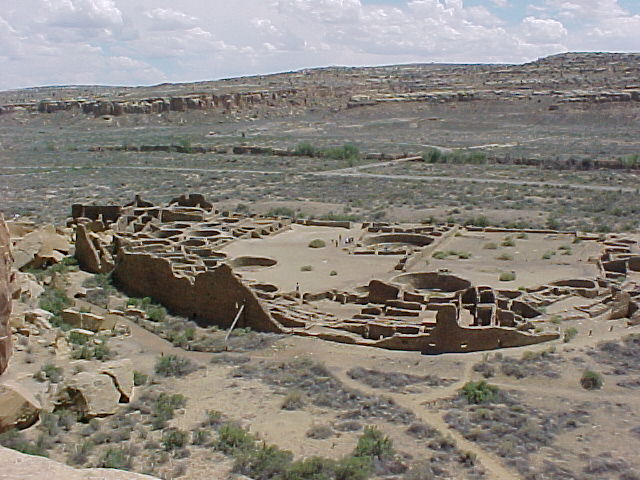
An Algonquin Village 

            Today, many people identify with the various Algonquin peoples. Some of the many tribes that have Algonquin roots are the Cheyenne, Cree, Creeks, Delaware, Fox, Kickapoo, Mahican, Menominee, Mohegan, Ojibwa, Pequot, Pottawotomi, Powhatan, Sac, and Shawnee. Eight tribes are recognized by the state of Virginia as having ancestral ties to the Powhatan confederation: the Upper Mattaponi; the Chickahominy; the Eastern Chickahominy; the Nansemond; the Rappahanock; and the Monacan Nation. The Pamunkey and Mattaponi are the only two peoples in Virginia who have retained at least some of their ancestral lands on reservations. At the end of the future chapter on the English colony at Jamestown, we will learn more about the creation of this historical park.
Swamp on Jamestown Island (Photo by J. Hunner)

Colonial National Historical Park
P.O. Box 210
Yorktown, VA 23690
757-856-1200

Related Sites:
Jamestown Settlement: http://www.historyisfun.org/jamestown-settlement.htm.


[1] Potter, Commoners, 3.
[2] Potter, 169.

Monday, February 15, 2016

Chaco Culture National Historic Park near Nageezi, New Mexico


On the plateau above Chaco Canyon rests the multi-room ruins of Pueblo Alto. The human made trail up the cleft in the canyon’s cliff and along the plateau dates back a thousand years. During the summer monsoon season with its afternoon thunderstorms, a person climbing up out of the canyon and hiking to Pueblo Alto sometimes dodges downpours and sees nearby lightning strikes. Standing in the ruins of Pueblo Alto, buffeted by wind, I saw a broad road sweeping north toward the Salmon and Aztec ruins some thirty miles away. In fact, Pueblo Alto is one of the gateways into Chaco Canyon, the end of a massive network of roads which funneled peoples and goods to this desert center from around North and Central America.
Artist's Recreation of Pueblo Bonito in 12th Century (NPS)
Set at 5,000 feet above sea level amidst a parched landscape which gets less than ten inches of annual rainfall, the Four Corners region of the Southwest holds a sparse beauty of earthy tones, hardy plants, and wide open spaces. Mountain ranges fifty miles away frame the horizons, and mesas punctuate the foreground like desert islands. Chaco Canyon cuts through the landscape with its mile wide trough which runs east to west for twenty miles. Scattered along the canyon floor and interspersed on the plateau tops are over a dozen major ruins and numerous smaller ones, all illustrating the many skills of the Chaco builders.

The Chacoans created a sophisticated civilization between 900 and 1200 Current Era (CE). They grew corn which like elsewhere transformed their ancestors from hunters and gatherers to farmers. To this day, Native Americans in New Mexico talk about the three sisters of food—corn, squash, and beans. Perhaps the most important of these sisters is corn, sometimes called the Corn Mother. Other foods, unknown to the rest of the world, also developed in the Americas. Squash, beans, chiles, manioc, potatoes, chocolate, and tobacco are some of the unique crops that provided healthy nutrition. In fact, these foods provided Americans a better diet than the Europeans had at the time. Once these crops crossed over to Europe, they continued to revolutionize people’s lives with better nutrition and even prevented starvation. We will explore this “Columbian Exchange” more in a later posting.

As the largest complex in the Chaco valley, Pueblo Bonito had 650 rooms spread out over two acres in a D shaped structure. The long edge of the D faces south for solar gain but also for the important orientation along the cardinal points treasured by the Chacoans. Pueblo Bonito, with its earliest construction begun in the 10th century, rose five stories. Until the 20th century, Pueblo Bonito was the largest built structure in the United States.
Pueblo Bonito (Photo by J. Hunner)

Room at Pueblo Bonito with vigas (Photo by J. Hunner)
It grew over three centuries in a way that entailed planning on a complicated and massive scale.  Take for instance the wood roof beams (or vigas). Excavations of the earliest vigas show that they came from nearby piñon trees. The Chacoans quickly deforested the piñon trees so they had to go to the nearby mountain ranges for their timber. At the Chuska Mountains some fifty miles west, work crews felled large Ponderosa Pine trees with stone axes. While still green and soft, Chacoans chopped them up into the right size for the various rooms. The vigas then dried for two years to make them lighter to carry. Men then carried these logs fifty miles and built the rooms of the great pueblos and kivas at Pueblo Bonito. Archeologists estimate that 215,000 vigas were used in building the Great Houses and the other structures in Chaco Canyon.

In the middle of the pueblos’ plazas and interspersed among their numerous rooms are often circular kivas where clans gathered to worship, socialize, teach, and work. At Pueblo Bonito, thirty-five kivas grace the ruin. These numerous places show that the Chacoans were likely a deeply religious people.
Kiva at Pueblo Bonito (Photo by J. Hunner)
For decades, archeologists have wondered why humans established a dense urban complex in a harsh desert setting. Some have speculated that the canyon served as a distribution center to share the harvest around the Chacoan region to communities whose crops had failed. Others proposed that it was a seasonal ceremonial center, visited by a large number of peoples from the outlying communities spread around the region. A peculiar fact uncovered by the archeologists is that there are relatively few burials at Chaco Canyon. They concluded that the large pueblos with hundreds of rooms housed only a couple of thousand people, whose population swelled during the seasonal periods of ritual and festivals.

Here’s where it gets pretty interesting. Rising up out of the east end of the canyon lies Fajada Butte, a tall lone mesa where Anna Sofer found a spiral petroglyph she calls the Sun Dagger half way up the mesa. This spiral, carved into a rock hidden behind three large slabs, is a time keeper. A dagger of sunlight bisects the shadowed spiral on the summer solstice. At the equinoxes, a dagger of light frames the spiral. On the solstices and equinoxes, signal fires spread the news to the whole Four Corners region. Using their built environment as time pieces, the Chacoans had a precise seasonal calendar.
Slab casting sunrise shadow on spiral with inset of Sun Dagger (Photo from www.solsticeproject.org/lunarmark.htm)
Some Chaco buildings perform an even more amazing feat: they track the 18.2 year progression of where the moon rises in the east. At the pueblo of Chetro Ketl on the canyon floor, one of the walls runs along a straight line for about 300 feet. This alignment points to the spot on a nearby cliff where the moon rises on the farthest northern point of its 18.2 year cycle. Few if any other buildings in the world orient so precisely to this subtle lunar cycle.

Prehistoric Stairways climbing out of the Canyon 
Roads radiate out from the canyon as straight avenues. Ancient stairs carved into the cliff faces funneled people into and out of the canyon where they then used eighteen feet wide roads lined with stone curbs to travel to the over 150 other Great Houses and beyond. Sea shells from the Pacific Ocean, soapstone from the Midwest, and amazingly, parrot feathers from the tropics of Central America have surfaced in the excavations at Chaco.  For example, in 1941, park personnel, wanting to stabilize a cliff face that towered over Pueblo Bonito, cleaned out the cleft at the base of the cliff. After they removed the rock and debris, they found a Macaw parrot feather used as a prayer stick deposited there 1,000 years ago. They removed that too. Within a couple of months, this part of the cliff calved off and smashed a section of Pueblo Bonito. Parrot feathers, soapstone, seashells provide evidence that Chacoans traded with faraway places.


Chacoan Road network (Map by USGS)
The end of the human habitation at Chaco Canyon lies in as much mystery as its purpose. Here’s some theories: perhaps communities collapsed as a fifteen year drought around 1150 fried the region’s corn fields. Or perhaps warfare doomed the culture, as a new wave of migrants swept forcefully through area. Whatever the reason, the Ancestral Pueblo peoples left in a well ordered manner. Kiva roofs came off, and the vigas set on fire. This took weeks to do which indicates that the end of Chaco was not a panicked retreat, but an orderly and, not surprisingly for the master builders of the Southwest, planned event.

The diaspora from Chaco spread to all directions. When they left the Chaco region, the Ancestral Pueblo people migrated to places with more abundant and steady sources of water like the San Juan River to the north and the Rio Grande to the east. Many of the modern pueblos in New Mexico and Arizona are descendants of the Chacoan people.

Pot hunters in the late 19th century destroyed the ruins looting the valuable artifacts left behind by the Chacoans. Protection and preservation began with Richard Wetherill, an amateur archeologist and cowboy. He hired 100 Navajos to help with his excavation of the ruins and sent more than 60,000 pieces of turquoise, pottery, and stone tools to the American Museum of Natural History on the East Coast.

In 1907, President Teddy Roosevelt created the Chaco Canyon National Monument under a provision of the Antiquities Act of 1906.  Chaco Canyon then became part of the NPS at its creation in 1916. In 1987, UNESCO designated Chaco as a World Heritage Site.

Walking through the impressive ruins of Chaco Canyon, climbing out of the valley on ancient stairs 1,000 years old, hiking across the desert plateaus on wide roads lined with boulders to outlier complexes, I feel in awe of the people who lived here so long ago. With stone tools, they fashioned a complex civilization which documented the movement of the heavens and passage of the seasons with the alignments of their large structures. They built roads to bring their far flung peoples to the canyon and to trade with other civilizations 1,500 miles away. It is one of the most amazing and inspiring places in the United States.
Fajada Butte looking southwest (Photo by J. Hunner)
Chaco Culture National Historical Park
Box 220
Nageezi, New Mexico 87037
505.786.7061
www.nps.gov/chcu

Related NPS sites:
Aztec Ruins National Monument, New Mexico
Bandelier National Monument, New Mexico
Canyon de Chelly National Monument, Arizona
Casa Grande Ruins National Monument, Arizona
Gila Cliff Dwellings National Monument, New Mexico
Mesa Verde National Park, Colorado
Petroglyph National Monument, New Mexico
Salinas Pueblos Missions National Monument, New Mexico