Contact between Americans and the Spanish
Traveling up the spine of Mexico and across the Chihuahuan Desert, Spanish explorers and then settlers pushed north from Mexico City,
possibly following Native American trails. Forbidding deserts, waterless
days, and harsh sun challenged the travelers. The interior lands can be an
unforgiving landscape, especially as Contact between the Americans and the
Spanish colonizers launched decades of war as well as exchange.
Spanish Encounter Native Americans
The Spanish made first contact with native peoples on the
continent. In 1519, Hernán Cortés de Monroy y Pizarro marched on Tenochtitlan,
the capital of the Aztec empire in Mexico and home to over 200,000 people.
After two years of siege, the Aztec fell to Cortes, his soldiers, and their Indian
allies. The gold and other treasures of the Aztecs fueled Spanish explorers who
then found more gold in the Incan empire in Peru.
 |
| Tlaxcalan allies with Spaniards attacking Aztecs (Florentine codex 1579) |
In the 16th century, Spaniards attempted colonies
in Georgia, Florida, North Carolina, and Virginia; however, these efforts
failed. Nonetheless, the Spanish believed that gold and other valuables waited
in the far north of New Spain.
Francisco Vázquez de Coronado y Luján found no wealth during
his expedition through the Southwest and into the Great Plains from 1540 to
1542. These 300 Spanish were the first
Europeans to encounter the Puebloan peoples, the first Europeans to see the Grand
Canyon and the Colorado River, the first Spaniards to fight Native Americans at
the Zuni and Tiguex pueblos, and the first to witness the nomadic Plains
Indians chasing the bison herds in Kansas. Despite traveling over 4,000 miles
from Mexico to Kansas and back, Coronado found no gold.
 |
| Coronado's Route 154-1542 |
Spanish colony of New Mexico
“Pasó por aquí.”
“I passed by here.” In 1605, Don Juan de Oñate carved these words into the soft
stone at the base of a windswept mesa in western New Mexico. Hundreds of Native
American petroglyphs preceded Oñate’s inscription at the place the Spanish
called El Morro (the Headland).
 |
| Onate's Paso por acqui engraving in 1605 at El Morro (Photo by Hunner) |
Several years earlier, Oñate led 700 settlers north and blazed
El Camino Real de Tierra Adentro (The
Royal Road to the Interior Lands). This 1,500 mile trail from Mexico City to northern
New Mexico opened up the Southwest to conquest, encounters, migration, and
commerce. This trail linked New Mexico to the rest of the world for the next three
centuries. Spain’s first successful colony in what would become the U.S.
preceded the English’s one at Jamestown by almost a decade.
In July 1598, Oñate’s colonizing group arrived in northern New Mexico and moved into
a ruin near the Pueblo of Ohkay Owingeh. They arrived too late to plant crops, and
in truth, few farmers had traveled with them. Instead most settlers knew mining,
convinced that gold lay nearby. Consequently, the colony took food and clothing
from the neighboring Puebloans. This made for strained relations.
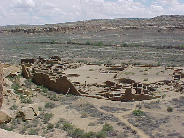
Relations between the Spanish colonizers and the Puebloans worsened at the end of 1598. An exploratory party led by Juan de Zaldivar, Oñate’s
nephew, sought to purchase corn flour from the people at the 1,000 year old Pueblo of Acoma.
The Puebloans attacked and killed Zaldivar and many of his twenty soldiers, but several escaped by jumping off the mesa cliffs. In response, Oñate sent his
soldiers to punish the Acoma people. A three day battle erupted around New
Year’s Day 1599 and ultimately, the Spanish hauled up a canon to the mesa top
and subdued the residents. In retaliation for their rebellion, Oñate enslaved the
children and women of Acoma and cut off the right foot of all men over the age
of twenty-five. With Contact came conflict and conquest.
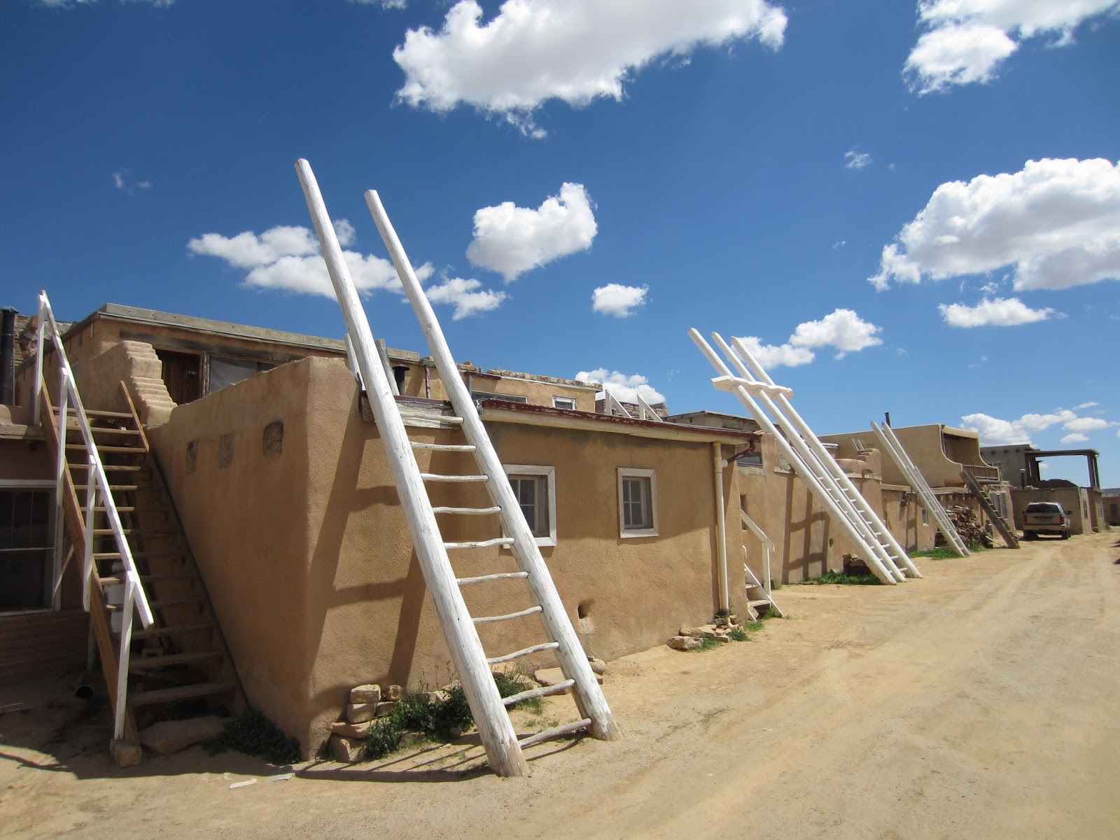 |
| Ladders to catch the rain clouds at Acoma (Photo by Hunner) |
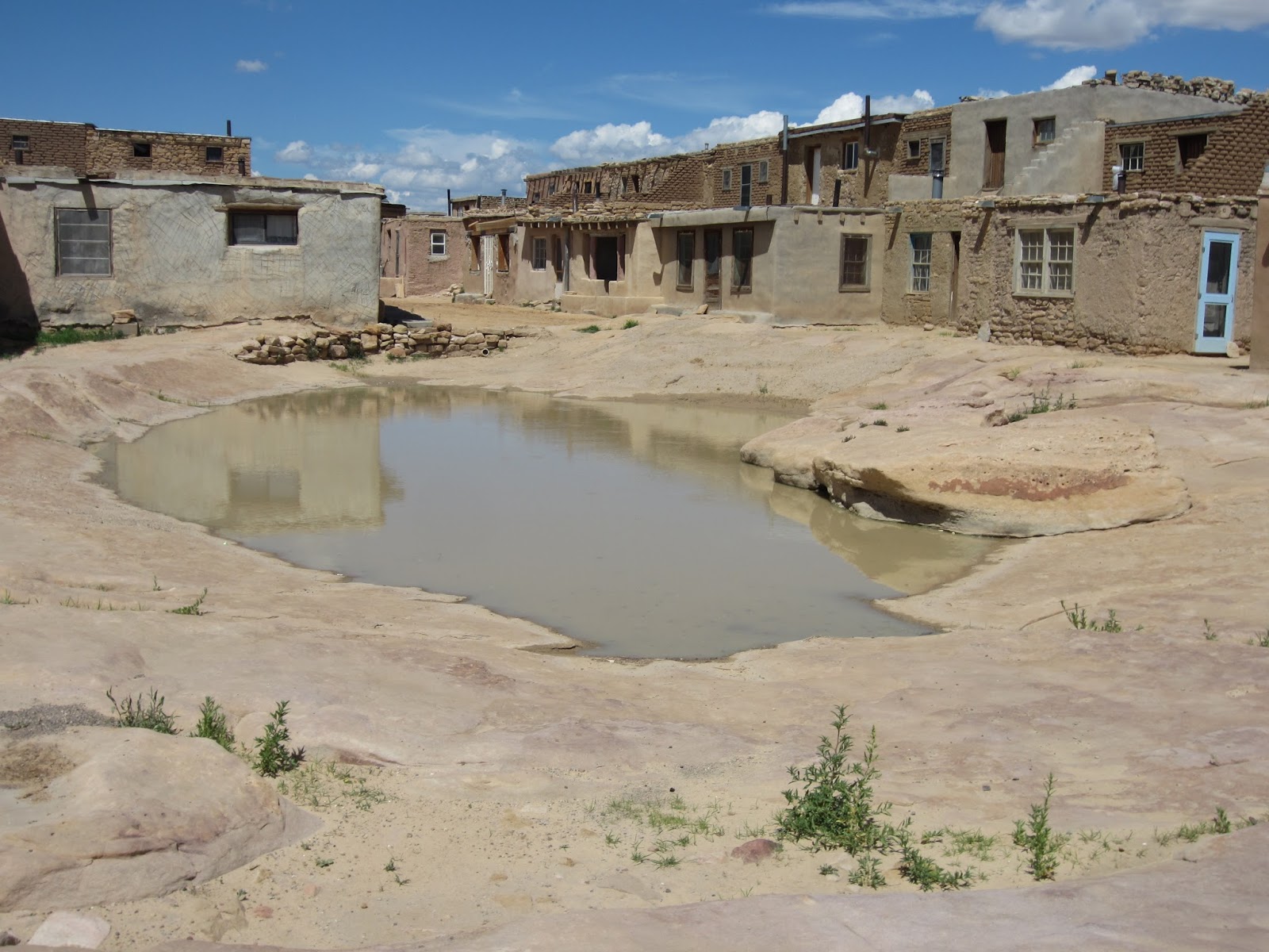 |
| Homes at Acoma (Photo by Hunner) |
The “Black Legend” posits that of all the Europeans who came
to the Western Hemisphere, the Spanish treated the Americans the worst, killing
and plundering native communities. True, some Spanish explorers did do that;
however, so did the English in New England during the Pequot War in the 1630s.
In fact, brutal warfare swept the continent from Contact until the late 19th
century. Europeans from all lands harshly treated Native Americans.
Sometime between 1607 and 1615, as Jamestown struggled to
establish itself in Virginia, the colonial capitol of New Mexico moved to La Villa Real de Santa Fe de San Francisco
de Asis (the Royal Town of the Holy Faith of Saint Francis of Assisi). Soon,
the Spanish built the Palace of the Governors, the final destination of the
Royal Road. The Palace served as the capitol for the Spanish, the Mexican, and
finally the U.S. governments of New Mexico. Today it houses the marvelous N.M. History Museum on the
Santa Fe Plaza.
 |
| The forbidding Chihuahuan Desert (Photo by Hunner) |
Traveling on El Camino Real challenged the settlers,
officials, priests, and traders. Mountains, deserts, hostile Native Americans,
long distances, and fierce weather all contributed to the arduous journey. Covering
ten to fifteen miles a day, it took about six months to go the 1,500 miles from
Mexico City. Because of the long sea and land journeys to get to northern New
Mexico from Europe, of all of the places in the worldwide Spanish empire, New
Mexico was “remote beyond compare.” Due to the isolation, decisions from Spain
took years to find their way back to New Mexico, so both governors and priests
had a relatively free rein.
The Spanish brought profoundly foreign concepts and shockingly
unusual items up the Camino Real. Concepts such as private land ownership, a
Christian faith, metal tools and weapons, and deadly microbes entered with
force. With Contact, both peoples adapted and adopted elements from the other. Each
side changed through cultural code switching (discussed in the Columbian
Exchange chapter) which in turn transformed the rest of the world.
Spanish officials and soldiers received an encomienda for their service which
granted them land and forced labor. Nearby Puebloans had to work for the
Spanish, often when their own crops were ready for harvesting. This encomienda
system made life difficult for the Americans.
Catholicism also injected strife into the colony. Priests tried
to convert Native Americans by establishing missions at pueblos and quashing
native religious practices and beliefs. Some Indians did embrace Christianity as a fatih,
others converted to acquire things like metal tool technology or to avoid persecution
by the priests. Despite these conversions, many Puebloans continued to follow their
traditional beliefs, and the destruction of sacred ceremonies and sites only
angered the indigenous peoples. Native
discontent erupted in 1680.
The decade before 1680 devastated the Puebloans. A drought
wasted their crops, disease struck many communities hard, and the Spanish
settlers and priests demanded labor and obedience. Some pueblo elders
attributed these hardships to the abandoning of their traditional religion for Christianity.
On August 10, 1680, Native Americans exploded in a colony wide rebellion called
the Pueblo Revolt which killed more than four hundred of the estimated 2,000
colonists and a significant number of Pueblo warriors. Twenty-one Franciscan priests
also died, some on their own altars.
The settlers who survived the original onslaught found
refuge in the Palace of the Governors. Fierce hand-to-hand fighting on the
plaza and streets of Santa Fe threatened the lives of the Spanish in the Palace.
On August 21, Gov. Antonio de Otermín negotiated an escape from Santa Fe and
abandoned the colony in New Mexico. Under the watchful eyes of the Puebloan
warriors, the settlers stumbled south down El Camino Real for over 300 miles
until they reached El Paseo de Norte on the Rio Grande.
 |
| Palace of the Governors on the Santa Fe Plaza with the flag of New Spain (Photo by Hunner) |
The Spanish remained south until 1692, when the new colonial
governor, Don Diego de Vargas, led supporters up the Camino Real to resettle
New Mexico. Rumors of new revolts swept New Mexico, and warfare did
periodically erupt for the rest of the century.
Why did the Spanish reopen El Camino Real and recolonize New
Mexico? Partially for geo-political purposes and partially for religious. By
the turn of the 17th century, France had made inroads into North
America and had started its own colonies at Quebec, Montreal, Detroit, Green
Bay, St. Louis, Mobile, Biloxi, Baton Rouge, and New Orleans. (We'll look at the French in North America in a future chapter). To counter the
French threat to the Spanish empire, New Mexico served as a buffer protecting
the silver mines at Zacatecas and elsewhere. Additionally, the Catholic church argued
that the many converted Puebloans had been abandoned, and that it was the crown’s
duty to provide for the souls of those peoples.
The Pueblo Revolt had many consequences. As the most successful
Native American rebellion against Europeans in North America, it illustrated
the tenuous nature of colonization, even after decades of settlement. At recolonization, the
Spanish changed, abolishing the encomienda
labor system and allowing native religious practices to live in concert with Catholicism.
In fact, an interesting syncretism exists today after mass on feast days, traditional dances take place on the pueblo's plaza. Some Pueblo
peoples attribute the preservation of their ancestral cultures and lands to the
Revolt. The Puebloans still inhabit their core lands while most other tribes in
the U.S. were forcefully moved to far flung reservations.
A last legacy of the Revolt was the spread of horses through the Great Plains and the West. Native Americans captured the animals left behind, and horse trading
spread throughout the Great Plains. This put Indians on fast moving mounts that
transformed their way of life and gave rise to the mobile bands of Commanches,
Apaches, Kiowas, Lakotas, and other tribes. As famed Native American scholar N.
Scott Momaday commented: "It must have been the realization of an ancient
dream to be elevated, to be severed from the earth, cut free. What a sense of
life that must have been, different from anything they'd ever known. With the
horse, their ancient nomadism was realized to the fullest extent, and they had
conquered their oldest enemy, which was distance."[1]
In 1906, President Teddy Roosevelt designated El Morro a
National Monument as one of the first such units allowed by the Antiquities
Act. The bi-national route of El Camino Real de Tierra Adentro became a National
Historic Trail of the National Park Service in October 2000.
 |
| The trail ruts of El Camino Real de Tierra Adentro today in southern New Mexico (Photo by Hunner) |
El Morro National Monument
HC61, Box 43
Ramah, New Mexico
87321-9603
505.783.4226
El Camino Real de Tierra Adentro National Historic Trail
National Trails Intermountain Region
P.O. Box 728
Santa Fe, New Mexico
87504-0728
505.988.6098